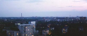
City in Rostov region, Russia
| Morozovsk Morozovsk | |
| City [1] | |
| Morozovskaya railway station in Morozovsk | |
| Flag Coat of arms | |
| Location of Morozovsk | |
| Morozovsk Location of Morozovsk Show map of Russia Morozovsk Morozovsk (Rostov region) Show map of Rostov region | |
| Coordinates: 48°22'N 41°50'E / 48.367°N Latitude 41.833°E / 48.367; 41.833 Coordinates: 48°22'N 41°50'E. / 48.367°N Latitude 41.833°E / 48.367; 41,833 | |
| A country | Russia |
| Federal subject | Rostov region [1] |
| Administrative region | Morozovsky district [1] |
| urban village | Morozovskoe [1] |
| Based | 1910 |
| City status from | 1941 |
| Height | 80 m (260 ft) |
| Population (2010 Census) [2] | |
| • General | 27 642 |
| • Evaluate (2018) [3] | 25 198 ( -8,8% ) |
| Administrative status | |
| • Capital from | Morozovsky district [1], urban-type settlement Morozovskoye [1] |
| Municipal status | |
| • Municipal district | Morozovsky municipal district [4] |
| • Urban village | Morozovskoe urban settlement [4] |
| • Capital from | Morozovsky municipal district [4], urban-type settlement Morozovskoye [4] |
| Timezone | UTC+3 (MSK[5]) |
| Postal code [6] | 347210, 347211, 347214, 347219, 347239 |
| Dialing code(s) | +7 86384 |
| OKTMO ID | 60634101001 |
Morozovsk
(Russian: Morozovsk) is a city and the administrative center of Morozovsky District in Rostov Oblast, Russia, located on the Bystraya River (a left tributary of the Seversky Donets), 265 km (165 mi) northeast of Rostov-on-Don, the administrative center areas. Population: 27,642 (2010 census); [2] 29,222 (2002 census); [7] 27,004 (1989 census). [8]
Story
Founded in 1910 as the village of Taubevskaya
Second Don District of the Don Army Region. The village was named in honor of the assigned military ataman, a German by birth, Baron Fedor Fedorovich Taube. The foundation of the village of Taubevskaya was preceded by the construction (from 1898 to 1900) of the Likhaya - Tsaritsyn railway line. The largest station on this section was Morozovskaya station (named after the nearby Morozovsky farmstead). In addition to the locomotive depot and other railway services, a railway settlement grew nearby. The sprawling farmsteads of Basov and Lyubimov came close to it.
In 1902, a meat trader named Razluka built a mechanized hunting slaughterhouse - today's meat processing plant. And entrepreneur Popov, who came from the village of Tsimlyanskaya, opened an iron foundry workshop on the banks of the Bystraya River for the repair of lobogreki and plows (today it is the Morozovskselmash plant).
The settlement of the newly formed village began in the spring of 1911. By the end of 1911, there were 300 new households in the village.
When the First World War began, German names began to be eradicated in Russia. The villagers gathered for a meeting and made their decision:
Verdict No. 116, June 29, 1915, Second Don District stanitsa gathering Taubevskaya, consisting of: the chairman of the stanitsa ataman, constable Gnutov, and those who appeared at this gathering from among 86 Cossacks - officials of the stanitsa and farm administrations. Without touching on the personality of the late Ataman F. F. Taube, who served a lot for the Fatherland in general and the Don society in particular, the collection is aware of one thing, that the very name Taubevskaya, as a German word, is alien to the Cossacks, especially with the outbreak of hostilities with the hated Germans (the war of 1914 .), became unbearable, and abusive towards us, since the Cossacks of neighboring villages mockingly call us “fons”, therefore the collection sentenced: to petition for the renaming of our village, giving it a Russian name.
— Historical information about the formation of the city of Morozovsk
On April 24 (old style), 1917, by order of the military ataman of the Donskoy Army Region, it was renamed the village of Morozovskaya
.
During the civil war, the entire revolutionary committee of the village went over to the side of the whites, and twenty-year-old communist Grigory Ignatievich Myshansky single-handedly shot all the loyalists [ clarify
] and went to the Reds.
After the revolution, the village of Morozovskaya became the center of the Morozovsky district, and on November 27, 1938 it was classified as a workers' settlement. May 29, 1941 - the working village of Morozovsky was transformed into a city of regional subordination with the name Morozovsk.
Morozovsk during the Great Patriotic War
Morozovsk was occupied by German troops on July 15, 1942. Until January 1943, Abwehrgruppe 104, an Abwehr reconnaissance unit that worked in the interests of the 6th Army against the Southwestern, Stalingrad and Don Fronts, was stationed in the city.
Having been defeated in the Kotelnikovo area, the 4th German Tank Army retreated to the Morozovsk-Zimovniki line, intending to stop the advance of the Soviet troops of the Southern Front there.
On January 5, 1943, he was liberated from German troops by Soviet troops of the Southwestern Front during the offensive in the Voroshilovgrad direction:
- 3rd Guards Army consisting of: 14th Infantry Corps (Major General Gryaznov, Afanasy Sergeevich) consisting of: 50th Guards. SD (Major General Belov, Alexander Ivanovich), 159th SD (Colonel Anashkin, Mikhail Borisovich).
- 5th Tank Army consisting of: units of the 346th Infantry Division (Major General Stankevsky, Dmitry Ivanovich).
- 8th Cavalry Corps (Major General Borisov, Mikhail Dmitrievich) consisting of: 55th Cavalry Division (Colonel Chalenko, Ivan Terentyevich), 112th Cavalry Division (Major General Shaimuratov, Minigali Mingazovich).
- 17th Air Army consisting of: 282nd Air Corps (Lieutenant Colonel Ryazanov, Andrei Matveevich), parts of the 288th Air Force (Lieutenant Colonel Konovalov, Sergei Filippovich) 1st Mixed Air Corps (Major General of Aviation Shevchenko, Vladimir Illarionovich).
The troops who participated in the liberation of Morozovsk, Millerovo and other cities were thanked by order of the Supreme Commander-in-Chief I.V. Stalin dated January 25, 1943.
Map
| Morozovsk: maps |
Morozovsk: photo from space (Google Maps) Morozovsk: photo from space (Microsoft Virtual Earth)
| Morozovsk. Nearest cities. Distances in km. on the map (in brackets along roads) + direction. Using the hyperlink in the distance , you can get the route (information courtesy of the AutoTransInfo website) | |||
| 1 | Chernyshkovsky (Volgograd region) | 29 (47) | IN |
| 2 | Milyutinskaya | 32 (33) | WITH |
| 3 | Tatsinskaya | 44 (78) | SW |
| 4 | Oblivskaya | 53 (91) | IN |
| 5 | Zhirnov | 56 () | Z |
| 6 | Sholokhovsky | 58 (76) | Z |
| 7 | Gornyatsky | 65 (84) | Z |
| 8 | Soviet | 76 () | WITH |
| 9 | Krasnoyarsk | 79 () | YU |
| 10 | Surovikino | 79 (83) | IN |
| 11 | Tsimlyansk | 80 (88) | YU |
| 12 | Belaya Kalitva | 80 (95) | Z |
| 13 | Sinegorsky | 81 (123) | SW |
| 14 | Coke | 89 (105) | Z |
| 15 | Romanovskaya | 91 (120) | YU |
| 16 | Volgodonsk | 95 (106) | YU |
| 17 | Bokovskaya | 97 (185) | WITH |
| 18 | Kashary | 98 (115) | NW |
| 19 | Konstantinovsk | 101 (166) | SW |
| 20 | Ust-Donetsk | 106 (196) | SW |
| 21 | Deep | 112 (179) | Z |
| 22 | Staraya Stanitsa | 113 () | Z |
| 23 | Kamensk-Shakhtinsky | 115 (150) | Z |
| 24 | Tarasovsky | 116 (201) | Z |
| 25 | Semikarakorsk | 120 (197) | SW |
| 26 | Bolshaya Martynovka | 120 (233) | YU |
a brief description of
Located in the upper reaches of the river. Bystraya (left tributary of the Seversky Donets, Don basin), 265 km northeast of Rostov-on-Don. Railway junction lines (Morozovskaya station) and highways.
Territory (sq. km): 38
Information about the city of Morozovsk on the Russian Wikipedia site
Historical sketch
In the 1880s The Morozov farm arose, named after the first settler. The railway was opened in 1900. Morozovskaya station, named after this farm, which turned out to be 3 versts from it.
In 1910, half a mile from the station, a new village was formed, named Taubeevskaya after the name of the military ataman Baron von Taube. During the First World War, it was decided to change the name of the village, as derived from a German surname, but the renaming of the village to Morozovskaya after the name of the station was carried out only on April 24, 1917.
Workers' village of Morozovsky from November 27, 1938. City of Morozovsk from May 29, 1941.
During the Great Patriotic War of 1941-45, it was occupied by Nazi troops on July 15, 1942. It was liberated on January 5, 1943 by troops of the Southwestern Front during the offensive in the Voroshilovgrad direction.
Economy
JSC "Morozovskselmash" Enterprises for processing agricultural raw materials (meat processing plant, bakery plant, dairy plants, feed mills, etc.), elevator. Railway transport enterprises.
In the Morozovsky district, wheat, barley, millet, corn, peas, oats, and sunflowers are grown. Melon growing, vegetable growing. They raise cattle, sheep, and pigs. Poultry farming.
Deposits of clay, limestone.
| Population by year (thousands of inhabitants) | |||||||
| 1939 | 21.7 | 1996 | 29.3 | 2007 | 28.5 | 2015 | 26.3 |
| 1959 | 27.0 | 1998 | 29.3 | 2008 | 28.5 | 2016 | 25.8 |
| 1967 | 27 | 2000 | 28.9 | 2010 | 28.3 | 2017 | 25.5 |
| 1970 | 27.0 | 2001 | 28.7 | 2011 | 27.6 | 2018 | 25.2 |
| 1979 | 27.2 | 2003 | 29.2 | 2012 | 27.4 | 2019 | 24.8 |
| 1989 | 27.0 | 2005 | 28.8 | 2013 | 27.0 | 2020 | 24.6 |
| 1992 | 26.9 | 2006 | 28.7 | 2014 | 26.7 | 2021 | 24.2 |
Physiographic characteristics
Morozovsk is located in the northeast of the Rostov region, within the Don-Donetsk Plain, in the upper reaches of the Bystraya River. The average altitude above sea level is 73 m. Most of the city is located on the left bank of the river. Southern chernozems and chestnut soils are common in the city area.
By road, the distance to the city of Rostov-on-Don is 250 km, to the nearest city of Tsimlyansk - 88 km.
Climate
According to the Köppen-Geiger climate classification, the climate of Morozovsk is humid continental with hot summers and moderately cold winters (Dfa index). According to Alisov's climate classification, Morozovsk is characterized by a moderate continental climate.
Literature[edit]
- FSUE "Southern Aerogeodetic Enterprise" Atlas of Rostov Region Cities, 2007.
- Red Banner Kyiv. Essays on the history of the Red Banner Kyiv Military District (1919-1979). Second edition, corrected and expanded. Kyiv, publishing house of political literature of Ukraine, 1979.
- Military encyclopedic dictionary. M., Military Publishing House, 1984.
- Directory "Liberation of Cities: A Guide to the Liberation of Cities during the Great Patriotic War of 1941-1945." M. L. Dudarenko, Yu. G. Perechnev, V. T. Eliseev and others. M.: Voenizdat, 1985. 598 p.
Economy
The main volume of goods, works and services of an industrial nature shipped in the region is carried out by enterprises of industry, agriculture, construction and the housing and communal services complex.
Large and medium-sized industrial enterprises account for 98.0% of the volume of industrial products shipped in the region. The largest volume of industrial products is shipped by the Morozovsky branch of Aston OJSC - 83.8% and the Morozovsky branch of Klever JSC - 11.5%.
The following enterprises operate in the city of Morozovsk:
- Morozovsky branch of JSC "Clover" (former)
- Morozovsky branch of OJSC "Aston"
- Morozovskoye Moloko LLC (dairy plant)
- Service locomotive depot "Morozovskoe" of the North Caucasian branch of TMH-Service LLC
- MUP Editorial office of the newspaper "Morozovsky Vestnik".
Social infrastructure
Education
University Cossack cadet boarding corps (branch) of the Federal State Budgetary Educational Institution of Higher Education "Moscow State University of Technology and Management named after K. G. Razumovsky (First Cossack University)" in Morozovsk, Rostov region
Secondary vocational education
- Morozov Agro-Industrial College (until August 20, 2014 Vocational School 88)
Secondary general education
- MBOU Lyceum No. 1
- MBOU Gymnasium No. 5
- MBOU Secondary school No. 1
- MBOU Secondary school No. 3
- MBOU Secondary school No. 4
- MBOU Secondary school No. 6
Preschool education
- kindergarten No. 1 "Romashka"
- kindergarten No. 2 “Sun”
- kindergarten No. 3 “Firefly”
- kindergarten No. 8 “Rodnichok”
- kindergarten No. 37 “Kolobok”
- kindergarten "Fairy Tale"
Additional education
- The House for arts and crafts for children
- Children's and youth sports school
- Children's art school
Healthcare
Medical services for residents of the city of Morozovsk and settlements of the Morozovsky district are provided by:
- MBUZ "Central District Hospital" whose structure includes: a hospital with 275 beds, including 222 round-the-clock and 53 day hospital beds. The outpatient clinic network is represented by an outpatient department for adults for 400 visits per shift, an outpatient department for children for 100 visits per shift, and a dental clinic for 150 visits per shift.
- Morozovsky branch of the state budgetary institution of the Rostov region “Anti-tuberculosis clinical dispensary”.
Links[edit]
Notes[edit]
- ^ abcdefgh Law No. 340-ZS
- ^ a b Federal State Statistics Service (2011). All-Russian Population Census 2010. Volume 1 [All-Russian Population Census 2010, vol. 1]. All-Russian Population Census 2010 [All-Russian Population Census 2010] (in Russian). Federal State Statistics Service.
- "26. The size of the permanent population of the Russian Federation by municipalities as of January 1, 2022". Federal State Statistics Service. Retrieved January 23, 2022.
- ^ abcde Law No. 247-ZS
- "On the Calculation of Time". Official Internet portal of legal information
. June 3, 2011. Retrieved January 19, 2022. - Post office. Information and computing center of OASU RPO. ( Post office
).
Search for postal service objects ( postal Search for objects
) (in Russian) - ↑
Federal State Statistics Service of Russia (May 21, 2004). The population of the Russian Federation, cities of the Russian Federation as part of federal districts, urban settlements, settlements, settlements, settlements is 3 thousand or more people. [Population of Russia, its federal districts , subjects of the Federation, districts, urban settlements, rural settlements - administrative centers and rural settlements with a population of more than 3000 people] (XLS). All-Russian Population Census of 2002 [All-Russian Population Census of 2002] (in Russian). - All-Union Population Census of 1989 Population of Union and Autonomous Republics, Autonomous Regions and Districts, Territories, Regions, Urban Settlements and Village District Centers [All-Union Population Census of 1989: Current Population of Union and Autonomous Republics, Autonomous Regions and Districts, Territories, Regions , districts, urban settlements and villages performing the functions of district administrative centers]. All-Union Population Census of 1989 [All-Union Population Census of 1989] (in Russian). Institute of Demography of the National Research University: Higher School of Economics [Institute of Demography of the National Research University: Higher School of Economics]. 1989 - via Demoscope Weekly
.
Transport
Automotive
The M21 federal highway runs near the city. The city is also a hub; regional roads pass through it: Morozovsk-Salsk, Morozovsk-Kashary. Many passing bus routes to Makhachkala, Voronezh, Astrakhan, Volgograd, Millerovo, Rostov, Lugansk, Donetsk, Volgodonsk, Elista.
In the city there is a stopping point "Morozovsky" PJSC Donavtovokzal, which is a transit point on the federal highway M21 "Volgograd - Kamensk-Shakhtinsky". The transit location allows you to get to the cities of Volgograd, Volgodonsk, Rostov-on-Don.
City public transport of Morozovsk is represented by four bus routes ( No. 1 (Right) “Gortopsbyt-Vetstsantiya”, No. 3 (Right) “Camping – Kirpichny”, No. 6 “Communication Center-Zapadnaya”
).
Railway
Junction railway station Morozovskaya of the North Caucasus Railway to: Likhaya, Volgograd, Kuberle (the Morozovskaya-Yuzhnaya - Cherkasskaya section was re-opened in January 2017).
In addition to the Morozovskaya station, large railway enterprises are located in the city. transport: service locomotive depot Morozovskaya and carriage repair depot Morozovskaya.
Religion
In the city of Morozovsk there are:
- the current Orthodox Church of the Nativity of the Blessed Virgin Mary (Morozovsk, Sovetskaya St., 58).
In October 1912, the Regional Board of the Don Army allowed the construction of the temple, and together with the temple it was planned to build a clergy house with outbuildings and a parochial school building. The temple was built according to the design of Fomin Konstantin Ivanovich. Construction was completed in a year and a half. However, the built temple became covered with cracks - the foundation began to settle. In 1914, an engineer examined the church and decided that the cracks were not dangerous and there were no obstacles to the opening of the temple. On April 25, 1915, the consecration of the temple took place. The temple was consecrated in honor of the Nativity of the Blessed Virgin Mary.
The rite of consecration of the temple with the blessing of His Eminence Mitrofan, Archbishop of Don and Novocherkassk was performed by priest Grigory Kravchenkov. On December 20, 1915, a parish with a clergy was opened. The parish consisted of about one and a half thousand parishioners.
The church operated until the mid-1930s. A military camp was built next to it and the church ended up on its territory. So the temple stood until the end of the 1940s. The bell tower on it was destroyed, the quadrangle above the temple part was dismantled. In the end, the temple was equipped as a military warehouse. In 2001, restoration of the temple began.
- Church of the Intercession of the Blessed Virgin Mary (Morozovsk, Pastukhova Street, 80). The shrines of the temple are: the icon of the Holy Martyr Nicholas Popov with a particle of relics, the icon of the Matrona of Moscow with a particle of relics, the icon of the Intercession of the Blessed Virgin Mary.
Morozovsk
(Rostov region)
OKATO code:
60234501
Founded:
1910
Urban settlement since:
1938
City since:
1941 City of district subordination (Morozovsky district, Rostov region)
Center:
Morozovsky district
Telephone code (reference phone)
| 86314***** | — |
Deviation from Moscow time, hours:
0
Geographical latitude:
48°21′
Geographical longitude:
41°50′
Altitude above sea level, meters:
80 Sunrise and sunset times of the Sun and Moon in the city of Morozovsk
Monuments and memorial signs
- Memorial complex in honor of those killed in the Civil War, World War II, as well as local conflicts.
- Near the railway station you can see a monument to the Steam Locomotive.
- Memorial cross-stone in memory of the Armenian genocide in Western Armenia in 1894-1923 and the glorious Russian warriors, Cossacks, who gave their lives for the liberation of Armenia.
- Stele to the Chinese communists who helped the Bolsheviks in the establishment of Soviet power in Morozovsk.
- A monument reminiscent of the genocide of local residents by fascist troops and the execution of several villages of the Morozovsky district on one day.
- Memorial sign to home front workers.
- A monument in honor of the fortieth anniversary of the victory of the Soviet people over the Nazi invader - a Mig-21 aircraft.
- Monument to soldiers of hot spots.
