City in Kurgan Oblast, Russia
For other places with the same name, see Petukhovo.
City in Kurgan Oblast, Russia
| Petukhovo Petukhovo | |
| City [1] | |
| Petukhovo station of the South Ural Railway | |
| Coat of arms | |
| Location of Petukhovo | |
| Petukhovo Location of Petukhovo Show map of Russia Petukhovo Petukhovo (Kurgan region) Show map of Kurgan region | |
| Coordinates: 55°04'N 67°54'E / 55.067°N W. 67.900°E / 55.067; 67.900 Coordinates: 55°04'N 67°54'E. / 55.067 ° N W. 67.900°E / 55.067; 67,900 | |
| A country | Russia |
| Federal subject | Kurgan region [1] |
| Administrative region | Petukhovsky district [1] |
| City of district subordination | Petukhovo [1] |
| Based | 1892 [2] |
| City status from | 1944 [2] |
| Height | 135 m (443 ft) |
| Population (2010 Census) [3] | |
| • General | 11 292 |
| • Evaluate (2018) [4] | 10 175 ( -9,9% ) |
| Administrative status | |
| • Capital from | Petukhovo district [1], urban-type settlement Petukhovo of district subordination [1] |
| Municipal status | |
| • Municipal district | Petukhovsky municipal district [5] |
| • Urban village | Petukhovo urban settlement [5] |
| • Capital from | Petukhovo municipal district [5], urban-type settlement Petukhovo [5] |
| Timezone | UTC+5 (MSK+2[6]) |
| Postal code [7] | 641640–641642 |
| OKTMO ID | 37626101001 |
| Web site | www.petuhovo.net |
Petukhovo
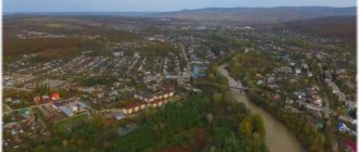
(Russian: Petukhovo) is a city and the administrative center of Petukhovsky District in Kurgan Oblast, Russia, located on the Ishim Plain 180 kilometers (110 mi) southeast of Kurgan, the administrative center of the region. Population: 11,292 (2010 census); [3] 12,661 (2002 census); [8] 14,584 people (1989 census). [9] It is located on the border between Kazakhstan and Russia.
Links[edit]
Notes[edit]
- ^ abcdefgh Law No. 316
- ^ B s d "General information" (in Russian). Retrieved March 21, 2022.
- ^ a b Federal State Statistics Service (2011). All-Russian Population Census 2010. Volume 1 [All-Russian Population Census 2010, vol. 1]. All-Russian Population Census 2010 [All-Russian Population Census 2010] (in Russian). Federal State Statistics Service.
- "26. The size of the permanent population of the Russian Federation by municipalities as of January 1, 2022". Federal State Statistics Service. Retrieved January 23, 2022.
- ^ abcde Law No. 419
- "On the Calculation of Time". Official Internet portal of legal information
. June 3, 2011. Retrieved January 19, 2022. - Post office. Information and computing center of OASU RPO. ( Post office
).
Search for postal service objects ( postal Search for objects
) (in Russian) - ↑
Federal State Statistics Service of Russia (May 21, 2004). The population of the Russian Federation, cities of the Russian Federation as part of federal districts, urban settlements, settlements, settlements, settlements is 3 thousand or more people. [Population of Russia, its federal districts , subjects of the Federation, districts, urban settlements, rural settlements - administrative centers and rural settlements with a population of more than 3000 people] (XLS). All-Russian Population Census of 2002 [All-Russian Population Census of 2002] (in Russian). - All-Union Population Census of 1989 Population of Union and Autonomous Republics, Autonomous Regions and Districts, Territories, Regions, Urban Settlements and Village District Centers [All-Union Population Census of 1989: Current Population of Union and Autonomous Republics, Autonomous Regions and Districts, Territories, Regions , districts, urban settlements and villages performing the functions of district administrative centers]. All-Union Population Census of 1989 [All-Union Population Census of 1989] (in Russian). Institute of Demography of the National Research University: Higher School of Economics [Institute of Demography of the National Research University: Higher School of Economics]. 1989 - via Demoscope Weekly
.
Sources [edit]
- Kurgan Regional Duma. Law No. 316 of December 27, 2007 “On the administrative-territorial structure of the Kurgan region,” as amended. Law No. 60 of July 2, 2015 “On amendments to the Law of the Kurgan Region” On the administrative-territorial structure of the Kurgan Region “”. Came into force after ten days from the date of official publication. Published: “New World”, Documents, issue No. 1, January 11, 2008 (Kurgan Regional Duma. Law No. 316 of December 27, 2007 “ On the administrative-territorial structure of the Kurgan region”
as amended by Law No. 60 of 2 July 2015 “
On Amendments to the Law of the Kurgan Region “On Administrative-Territorial Structure”).
Kurgan region " . Valid from the date of official publication.) - Kurgan Regional Duma. Law No. 419 of July 6, 2004 “On granting municipalities the status of a city district, municipal district, rural settlement, urban settlement, on the location of representative bodies of a municipal formation, urban settlement, on establishing the names of representative bodies of municipal formations, heads of municipal formations, local administrations. )", Ed. Law No. 70 of July 2, 2015 “On amendments to some Laws of the Kurgan Region.” Came into force on the date of official publication. Published: “New World”, No. 142, July 31, 2004 (Kurgan Regional Duma. Law No. 419 of July 6, 2004 On assigning the status of a city district, municipal district, rural settlement, urban settlement to municipalities; on establishing locations representative bodies of municipal formations, rural settlements; On approval of the names of representative bodies of municipal formations, heads of municipal formations, local administrations (executive bodies of municipal formations)
as amended by the Law of July 2, 2015 No. 70 “
On amendments to various Laws of Kurgan region
... Valid from the date of official publication.).
Petukhovo
The village of Yudino, the future city of Petukhovo, was founded in 1779 by Pavel Fedorovich Yudin, the son of Fyodor Prokopyevich and Anastasia Egorovna Yudin, who lived in the village of Ivankovo, Yaroslavl province, not far from Uglich. In the mid-1770s, Pavel Yudin was convicted of murder, which he committed in a drunken brawl, and was exiled to eternal settlement in Siberia. Having brought the convict to Chelyabinsk, the convoy allowed Pavel to independently complete the journey to the place of exile. Pavel reached the village of Teplodubrovnoye and temporarily stopped here to earn money. He worked as a driver and established himself as a hardworking and conscientious worker.
After a year, Pavel Fedorovich was allowed to stay and live in the village, and then was allocated a plot of land of 30 acres, 13 miles from Teplodubrovnoye, on the shore of Lake Yudino. After some time, his wife Olga Savelyevna and her son came to see him. Now they began to work together for the owner, who soon helped the family build a house. In 1779, the Yudin family settled in their own house - the first house of a farmstead that was emerging 200 meters from the lake. In 1781, two more families from Teplodubrovny moved here and built their own houses. Three years later, two civilian migrants from the Oryol province settled nearby. Pavel Yudin built a windmill that ground grain not only for his farm. The farm expanded, the village residents hired permanent and seasonal workers, and transported products to other cities and villages.
By the beginning of the 1820s. there were 10-12 courtyards in the farmstead. In 1822, Pavel Fedorovich Yudin died, and four years later Olga Savelyevna also died. Their children soon returned to the Yaroslavl province.
According to 1871 data, there were 104 residents in Yudino. In 1885 there were 40 households in the village. Residents cultivated the land, hunted and fished.
In 1891, the Russian government decided to build the Siberian Railway from the Samara-Zlatoust Mainline in the direction of Chelyabinsk - Kurgan - Irkutsk - Sretensk - Khabarovsk - Vladivostok. Emperor Alexander III instructed the heir to the throne, the future Emperor Nicholas II, to lay the foundation for the Siberian railway. On May 19, 1891, Nicholas II was present at the laying of the first railroad rails in Vladivostok. The construction of the railway gave impetus to the development of the village of Yudino. The Petukhovo station carried out sales of agricultural products in larger volumes than the city of Ishim, the center of the county, extending its influence far to the north. In 1896, the first train arrived at the station. Mainly bread and grain were exported.
By the end of the 19th century, the first large group of settlers, consisting of 46 families, arrived in Yudino from the village of Voznesenovka, Poltava province. They settled on the southern side along the railroad and founded a street they called Voznesenskaya (today it is Proletarskaya Street). Soon, a second group of settlers consisting of 42 families arrived from the Poltava province. They settled on the other side of the railway, forming a street called Port Arthur (today it is Lenin Street). This is how two societies were formed - Yudino and Voznesenskoye, located 1 km from each other. In 1899, by the decision of the Ishim district resettlement administration, the two societies were merged into one, which was called the “Yudino-Voznesenskoye Society of the Petukhovsky volost of the Ishim district of the Tobolsk province.”
By 1905, in the village of Yudino-Voznesenskoye there were 185 houses, there were streets: Pochtovaya (Oktyabrskaya), Shkolnaya (Karla Marx), Voznesenskaya (Proletarskaya), Port-Arturnaya (Lenina). In 1924, it was planned to transfer the village of Yudino to urban status, but these plans were not implemented.
On March 16, 1944, the village of Yudino was given the status of a city and renamed Petukhovo.
The city received further development in the 1960s. in connection with the construction of a central sewer system and the solution to the issue of water supply to the city. New streets and villages appeared: KMP, Vodoprovodchikov, SMP-290, Koopzverpromkhoz. In Petukhovo, large capital construction was carried out by PMK-1058, MSO, RSU, SMP-290, and PMK "Oblpotrebsoyuz". During this period, the buildings of secondary school No. 1 with a boarding school, secondary school No. 2, a hospital with a clinic, a dormitory SU-3, residential buildings No. 4 and 6 on K. Marksa Street, No. 46 and 48 on Krasnaya Street, a complex were built buildings on Kulisheva Street. The city's streets were paved and bus traffic was organized. Freight turnover at the Petukhovo station increased, and new access roads were built.
Currently, the leading enterprise of the city is the foundry and mechanical plant, founded in 1903, which played a significant role in the development of Petukhovo. As the city developed, new secondary schools were built, today there are three of them. In 1930, the oldest secondary technical educational institution was opened in the city, now it is the College of Mechanization and Electrification of Agriculture. Perestroika period of the 1990s. became difficult for the city. Until 1993, there were 8 preschool educational institutions in Petukhovo; in 2000, only one remained. In 2007, it was possible to restore the previously closed Kolobok kindergarten.
In 2005, the city's railway station was renovated; more than 6 million rubles were allocated for repairs. The walls of the station are lined with silver-gray metal siding, double-glazed windows have been installed that allow maintaining the desired temperature in the halls, the platform is lined with paving slabs, and the approach to trains has become more convenient.
External links [edit]
- Unofficial website of Petukhovo (in Russian)
| vteAdministrative divisions for the Kurgan region | |||
| Administrative center: Kurgan • Rural area. | |||
| Districts |
| ||
| Cities and towns |
| ||
| Urban settlements |
| ||
An excerpt characterizing Petukhovo (Kurgan region)
At the same time, the chief of artillery of the 1st Corps, General Pernetti, with 30 guns of the Compan division and all the howitzers of the Dessay and Friant divisions, will move forward, open fire and bombard the enemy battery with grenades, against which they will act! 24 guns of the Guards artillery, 30 guns of the Compan division and 8 guns of the Friant and Desseux divisions, a total of 62 guns. The chief of artillery of the 3rd Corps, General Fouche, will place all the howitzers of the 3rd and 8th Corps, 16 in total, on the flanks of the battery, which is assigned to bombard the left fortification, which will total 40 guns against it. General Sorbier must be ready, at the first order, to march with all the howitzers of the Guards artillery against one or another fortification. Continuing the cannonade, Prince Poniatowski will head towards the village, into the forest and bypass the enemy position. General Compan will move through the forest to take possession of the first fortification. Upon entering the battle in this way, orders will be given according to the actions of the enemy. The cannonade on the left flank will begin as soon as the cannonade of the right wing is heard. The riflemen of Moran's division and the Viceroy's division would open heavy fire when they saw the beginning of the attack of the right wing. The Viceroy will take possession of the village [of Borodin] and cross his three bridges, following at the same height with the divisions of Morand and Gerard, which, under his leadership, will head to the redoubt and enter the line with the rest of the army. All this must be done in order (le tout se fera avec ordre et methode), keeping the troops in reserve as much as possible. In the imperial camp, near Mozhaisk, September 6, 1812.” This disposition, written in a very unclear and confused way, if we allow ourselves to regard his orders without religious horror at Napoleon’s genius, contained four points - four orders. None of these orders could be or were carried out. The disposition says, first: that the batteries set up at the place chosen by Napoleon with the Pernetti and Fouche guns aligned with them, a total of one hundred and two guns, open fire and bombard the Russian flashes and redoubts with shells. This could not be done, since the shells from the places appointed by Napoleon did not reach the Russian works, and these one hundred and two guns fired empty until the nearest commander, contrary to Napoleon’s orders, pushed them forward. The second order was that Poniatowski, heading towards the village into the forest, should bypass the left wing of the Russians. This could not be and was not done because Poniatovsky, heading towards the village into the forest, met Tuchkov there blocking his way and could not and did not bypass the Russian position. Third order: General Kompan will move into the forest to take possession of the first fortification. Compan's division did not capture the first fortification, but was repulsed because, leaving the forest, it had to form under grapeshot fire, which Napoleon did not know. Fourth: The Viceroy will take possession of the village (Borodino) and cross his three bridges, following at the same height with the divisions of Maran and Friant (about which it is not said where and when they will move), which, under his leadership, will go to the redoubt and enter the line with other troops.