Geographical location of the Voronezh region
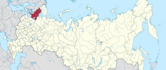
A satellite map of the Voronezh region clearly shows its geographical location.
It is located on the East European Plain. The region shares a common border with Ukraine. In the south it borders with the Rostov and Volgograd regions. The eastern border of the region runs with the Tambov and Saratov regions. Its northern neighbor is the Tula region, its western neighbor is the Belgorod, Kursk and Lipetsk regions. There are 829 rivers in the region. The most significant of them: Don and Khoper. The main part of the region's territory belongs to the steppe zone. Almost 78% of its area is occupied by agricultural land. There is a biosphere reserve in the region.
Climate
The region is included in the temperate continental climate zone. The average temperature in winter months is -10°C. In summer the air warms up to +20-25°C. Up to 600 mm of precipitation falls in the region annually.
Population
The urban population of the region exceeds 64% of the total number of residents of the region. Almost 95.5% of the population are Russians, 1.9% are Ukrainians.
Economy
Despite the well-developed agricultural sector in the region, the Voronezh region belongs to the industrial regions of the country. It generates electricity and produces mechanical engineering and electronics products. Voronezh enterprises are very famous in the country:
- Tire plant, part of the group.
- JSC "United Aircraft Corporation".
Based on the raw material base of the region, enterprises producing construction materials operate. The region has a well-developed food and chemical industry.
Administrative-territorial structure
Anna Povorino Verkhnyaya Khava Repyovka Ramon Novaya Usman Panino Semiluki Ertil Ternovka Gribanovsky Khokholsky Nizhnedevitsk Kashirskoye Ostrogozhsk Bobrov Liski Talovaya Novokhopyorsk Buturlinovka Kamenka Verkhny Mamon Vorobyovka Pavlovsk Kalach Podgorensky Petropavlovka Olkhovatka Rossosh Kantemirovka Boguchar Voronezh Novovoronezh Borisoglebsk
According to the Law “On the administrative-territorial structure of the Voronezh region
", a subject of the Russian Federation includes the following administrative-territorial units:
- 3 urban districts (Borisoglebsky, Voronezh, Novovoronezh)
- 31 municipal districts (districts)
- 28 urban settlements,
- 416 rural settlements.
The administrative center of the Voronezh region is the city of Voronezh
.
The city of Voronezh is divided into districts:
- Zheleznodorozhny district
- Kominternovsky district
- Levoberezhny district
- Leninsky district
- Sovetsky district
- Central District.
From February 1, 2022, Voronezh districts are excluded from OKATO.
Voronezh region. Districts
Located in the central European part of the Russian Federation. The area of the region is 52,216 square meters. km, its population is 2,331,506 people, of which 95.5% are Russian. The population density is about 44 people per sq. km. The administrative center is the city of Voronezh with a population of 1 million people. The largest cities in the region: Borisoglebsk, Rossosh, Ostrogozhsk, Liski, Novovoronezh.
The relief of the Voronezh region is predominantly flat, most of it is forest-steppe, and in the southeast there is steppe. The largest river: Don, in total there are 1343 rivers in the region, including Bityug, Voronezh and Khoper, many lakes and artificial ponds. They contain a huge variety of fish; on the banks there are a lot of recreation centers, sanatoriums, and nature reserves. The most interesting tourist site: Divnogorye. This is a unique Orthodox church, carved by monks inside a huge chalk mountain.
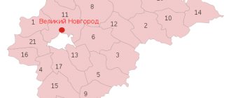
Voronezh region. Map (The dotted line indicates the boundaries of the area on the map)
The region has large reserves of chalk, many deposits of non-metallic raw materials and phosphorites. In the near future it is planned to begin developing deposits of nickel, copper and platinum. The main industries are food, engineering and electricity. Voronezh is considered the capital of the Black Earth Region, and the land itself is the main resource here. It borders with the Lugansk region of Ukraine, 7 regions of Russia: Belgorod, Volgograd, Kursk, Lipetsk, Rostov, Saratov and Tambov. It is divided into 31 municipal districts, as well as 3 urban districts. There are 29 cities and 471 rural settlements on the territory.
Districts of the Voronezh region:
|
|
|
Administrative-territorial division of the Voronezh region Map by district
Cities and towns:
Voronezh Borisoglebsk Liski Ostrogozhsk Novovoronezh Semiluki Pavlovsk Novaya Usman Kalach Bobrov Rossosh Buturlinovka
Rural and urban settlements
Below is a list of urban and rural settlements distributed among the regions of the region.
Anninsky district
- Anninskoe urban settlement
- Artyushkinskoye rural settlement
- Arkhangelsk rural settlement
- Berezovskoe rural settlement
- Brody rural settlement
- Vasilyevskoe rural settlement
- Verkhnetoydenskoe rural settlement
- Deryabkinskoe rural settlement
- Krasnologskoe rural settlement
- Mosolovskoe rural settlement
- Nashchekinskoye rural settlement
- Nikolaevskoe rural settlement
- Nikolskoye rural settlement
- Novozhiznenskoe rural settlement
- Novokurlakskoe rural settlement
- Ostrovskoye rural settlement
- Pugachevskoe rural settlement
- Ramon rural settlement
- Rubashevskoe rural settlement
- Sadovskoe rural settlement
- Starotoydenskoe rural settlement
- Starochigolskoe rural settlement
- Khleborodnenskoye rural settlement
- Urban settlement Bobrov
- Annovskoye rural settlement
- Verkhneikoretskoye rural settlement
- Korshevskoe rural settlement
- Lipovskoe rural settlement
- Mechetsky rural settlement
- Nikolskoye rural settlement
- Oktyabrskoe rural settlement
- Pchelinovskoe rural settlement
- Semeno-Alexandrovskoe rural settlement
- Slobodskoe rural settlement
- Sukho-Berezovskoye rural settlement
- Troynyanskoye rural settlement
- Khrenovskoe rural settlement
- Chesme rural settlement
- Shestakovskoe rural settlement
- Shishovskoe rural settlement
- Yudanovskoe rural settlement
- Yasenkovskoe rural settlement
- Urban settlement Boguchar
- Dyachenkovskoe rural settlement
- Zaliman rural settlement
- Lipchanskoe rural settlement
- Lugovskoye rural settlement
- Medovskoe rural settlement
- Monastyrschinskoe rural settlement
- Pervomaiskoe rural settlement
- Podkolodnovskoe rural settlement
- Popovskoye rural settlement
- Radchenskoye rural settlement
- Sukhodonetskoe rural settlement
- Tverdokhlebovskoe rural settlement
- Filonovskoye rural settlement
- Urban settlement Buturlinovka
- Urban settlement Nizhny Kislyai
- Berezovskoe rural settlement
- Vasilyevskoe rural settlement
- Velikoarkhangelsk rural settlement
- Gvazden rural settlement
- Karaychevo rural settlement
- Klepovo rural settlement
- Kozlovskoye rural settlement
- Kolodeevskoye rural settlement
- Kucheryaevskoe rural settlement
- Ozerskoye rural settlement
- Puzevskoye rural settlement
- Serikovskoe rural settlement
- Filippenkovskoe rural settlement
- Chulokskoe rural settlement
- Verkhnemamonskoye rural settlement
- Gorokhovskoe rural settlement
- Derezovskoe rural settlement
- Lozovskoe 1st rural settlement
- Mamonovskoe rural settlement
- Nizhnemamonskoe 1st rural settlement
- Olkhovat rural settlement
- Osetrovskoe rural settlement
- Prirechenskoe rural settlement
- Russian-Zhuravskoe rural settlement
- Lozovskoye 1st rural settlement and Lozovskoye 2nd rural settlement in Lozovskoye 1st rural settlement with the administrative center in the village of Lozovoye;
- Nizhnemamonskoye 1st rural settlement and Nizhnemamonskoye 2nd rural settlement in Nizhnemamonskoye 1st rural settlement with the administrative center in the village of Nizhny Mamon.
Bobrovsky district
The territory of the Bobrovsky municipal district includes the following urban and rural settlements
Bogucharsky district
The territory of the Bogucharsky municipal district includes the following municipalities:
Buturlinovsky district
The territory of the Buturlinovsky municipal district includes the following urban and rural settlements:
Verkhnemamonsky district
The territory of the Verkhnemamonsky municipal district includes the following rural settlements:
Law of the Voronezh region dated June 28, 2013 No. 88-OZ, transformed by merging:
Verkhnekhava district
The territory of the Verkhnekhava municipal district includes the following rural settlements with administrative centers:
Vorobyovsky district
The territory of the Vorobyovsky municipal district includes the following rural settlements:
By the Law of the Voronezh Region of March 2, 2015 No. 18-OZ, the following were merged into newly formed municipalities:
- Berezovskoye, Muzhichanskoye and Verkhnebykovskoye rural settlements into the Berezovskoye rural settlement with the administrative center in the village of Berezovka;
- Vorobyovskoye, Rudnyanskoye and Leshchanivskoye rural settlements into Vorobyovskoye rural settlement with the administrative center in the village of Vorobyovka;
- Krasnopolskoye, Nikolskoye 1st rural settlement and Nikolskoye 2nd rural settlements into Nikolskoye 1st rural settlement with the administrative center in the village of Nikolskoye;
- Solonetskoye and Kvashinskoye rural settlements into Solonetskoye rural settlement with the administrative center in the village of Solontsy.
Gribanovsky district
The territory of the Gribanovsky municipal district includes the following urban and rural settlements:
Kalacheevsky district
The territory of the Kalacheevsky municipal district includes the following rural and urban settlements:
Kamensky district
The territory of the Kamensky municipal district includes the following rural and urban settlements:
Kantemirovsky district
Municipalities:
Kashirsky district
Municipalities:
Liskinsky district
Municipalities:
Nizhnedevitsky district
Municipalities:
Novousmansky district
Municipalities:
Novokhopyorsky district
Municipalities:
By the Law of the Voronezh Region of November 25, 2011 No. 161-OZ, the following were transformed by merging:
- urban settlement - the city of Novokhopyorsk, Novokhopyorskoye urban settlement, Alferovskoye, Kamenno-Sadovskoye, Novoilmenskoye and Rusanovskoye rural settlements into an urban settlement - the city of Novokhopyorsk;
- Kolenovskoye, Berezovskoye, Dolinovskoye and Podosinovskoye rural settlements in the Kolenovskoye rural settlement with the administrative center in the village of Elan-Koleno;
- Mikhailovskoe and Polezhaevskoe rural settlements into the Mikhailovskoe rural settlement with the administrative center in the village of Mikhailovsky;
- Podgorenskoye and Yarkovskoye rural settlements into the Yarkovskoye rural settlement with the administrative center in the village of Yarki;
- Pykhovskoye and Burlyaevskoye rural settlements into Pykhovskoye rural settlement with the administrative center in the village of Pykhovka.
Olkhovatsky district
Municipalities:
Law of the Voronezh region dated October 2, 2013 No. 118-OZ, transformed by merging:
- Olkhovatsky urban settlement, Bazovskoye and Zabolotovskoye rural settlements in Olkhovatsky urban settlement with an administrative center in the working village of Olkhovatka;
- Maryevskoye, Marchenkovskoye and Kravtsovskoye rural settlements into the Maryevskoye rural settlement with the administrative center in the Maryevka settlement;
- Karayashnikovskoye and Yurasovskoye rural settlements in Karayashnikovskoye rural settlement with the administrative center in the Karayashnik settlement.
Ostrogozhsky district
Municipalities:
Pavlovsky district
Municipalities:
Paninsky district
Municipalities:
Law of the Voronezh region dated April 13, 2015 No. 42-OZ, transformed by merging:
- Krasnonovskoe and Chernavskoe rural settlements into Chernavskoe rural settlement with the administrative center in the village of Chernavka;
- Borshchevskoye and Progressovskoye rural settlements into the Progressovskoye rural settlement with the administrative center in the village of Mikhailovka 1st;
- Sergeevskoye and Oktyabrsky rural settlements into the Oktyabrskoye rural settlement with the administrative center in the village of Oktyabrsky;
- Martynovskoye and Kriushanskoye rural settlements into the Kriushanskoye rural settlement with the administrative center in the village of Kriusha.
Petropavlovsky district
Municipalities:
Povorinsky district
Municipalities:
Podgorensky district
Municipalities:
Ramonsky district
Municipalities:
Repyovsky district
Municipalities:
Rossoshansky district
Municipalities:
Semiluksky district
Municipalities:
By the Law of the Voronezh Region of November 30, 2009 No. 145-OZ, transformed by merging:
- Zemlyanskoye, Malovereyskoye, Malopokrovskoye and Kazinskoye rural settlements into Zemlyanskoye rural settlement with the administrative center in the village of Zemlyansk;
- Nizhnevedugskoye, Gnilushanskoye and Melovatskoye rural settlements into the Nizhnevedugskoye rural settlement with the administrative center in the village of Nizhnyaya Veduga;
- Novosilskoye, Golosnovskoye and Troitskoye rural settlements into the Novosilskoye rural settlement with the administrative center in the village of Novosilskoye;
- Starovedugskoye and Staroolshanskoye rural settlements into Starovedugskoye rural settlement with the administrative center in the village of Staraya Veduga.
Talovsky district
Municipalities:
By the Law of the Voronezh Region of November 30, 2015 No. 163-OZ, the following were transformed by combining them:
- Abramovskoye, Abramovskoye 2nd and Elanskoye rural settlements - into the Abramovskoye rural settlement with the administrative center in the village of Abramovka;
- Alexandrovskoye, Vasilievskoye and Kazanskoye rural settlements - into Alexandrovskoye rural settlement with the administrative center in the village of Alexandrovka;
- Biryuchenskoye and Tishanskoye rural settlements - to the Tishanskoye rural settlement with the administrative center in the village of Verkhnyaya Tishanka;
- Kamenno-Stepnoye and Mikhinskoye rural settlements - into the Kamenno-Stepnoye rural settlement with the administrative center in the village of the 2nd section of the Institute named after. Dokuchaeva;
- Vyazovskoye and Sinyavskoye rural settlements - into Sinyavskoye rural settlement with the administrative center in the village of Sinyavka;
- Voznesenovskoye, Nikolskoye and Novochigolskoye rural settlements - into the Novochigolskoye rural settlement with the administrative center in the village of Novaya Chigla;
- Shaninskoye and Shaninskoye 2nd rural settlements - to the Shaninskoye rural settlement with the administrative center in the village of Plot No. 26;
- Anokhinskoye, Nizhnekamenskoye and Khorolskoye rural settlements - into the Nizhnekamenskoye rural settlement with the administrative center in the village of Nizhnyaya Kamenka.
Ternovsky district
Municipalities:
By the Law of the Voronezh Region of March 6, 2014 No. 19-OZ, the Narodnenskoye and Popovskoye rural settlements were united into the Narodnenskoye rural settlement with the administrative center in the village of Narodnoye.
By Law of the Voronezh Region dated July 6, 2022 No. 71-OZ, Nikolaevskoye and Tambovskoye rural settlements are united into the Tambovskoye rural settlement with the administrative center in the village of Tambovka.
By the Law of the Voronezh Region of March 4, 2022, the Novokirsanovskoye rural settlement was annexed to the Ternovskoye rural settlement with the administrative center in the village of Ternovka.
Khokholsky district
Municipalities:
By Law of the Voronezh Region dated April 5, 2011 No. 44-OZ, Staronikolskoye and Nikolsko-Emanchanskoye rural settlements were transformed, through merger, into Staronikolskoye rural settlement with the administrative center in the village of Staronikolskoye.
By the Law of the Voronezh Region of April 13, 2015 No. 40-OZ, the following were transformed by merging:
- Khokholskoye urban settlement, Emanchanskoye and Khokholskoye rural settlements into the Khokholskoye urban settlement with the administrative center in the working village of Khokholskoye;
- Gremyachenskoye and Rudkinskoye rural settlements into the Gremyachenskoye rural settlement with the administrative center in the village of Gremyache.
Ertil district
Municipalities:
Map of the Voronezh region with cities and villages
By selecting routes of the Voronezh region on the map, you can visit cities with interesting history.
These include the following settlements:
- On the site of Voronezh there used to be a Cossack village. This city has a developed manufacturing sector. On its territory there is a ceramic factory, a car repair company and an organization that produces medications. Also, the map of the Voronezh region describes in detail the largest enterprise in Russia that produces furniture. This is Black Earth Furniture. Recently, many entertainment and shopping complexes have been built in the city. There are more than 60 different markets in the city. The city center is home to magnificent historical sites. The Arsenal is considered the oldest museum in the city. Petrovsky Square with a fountain, a bronze statue and beautiful trees is considered an interesting place for walking.
- Borisoglebsk is considered one of the largest cities in the region. With a map of the Voronezh region with cities in good quality, you can see all the sights of the urban area. It is a city with many green spaces and small buildings.
- Rossosh is a city surrounded by forests where wild animals live. The city is considered an important railway center and is known for its chemical and food industries.
- A map of the Voronezh region with cities and villages will allow you to find the city of Liski. Many new buildings are appearing in the city. From Voronezh to the city it is about 115 km. The city has companies producing pipelines and metal structures. The city also has a river port and railway enterprises.
- It is worth highlighting Ostrogozhsk. It is famous for its tannery and numerous food processing plants.
Story
- At the time of its formation (1934), the region was divided into 84 districts: Alekseevsky, Aleshkovsky, Anninsky, Arkhangelsky, Berezovsky, Bobrovsky, Bogucharsky, Bondarsky, Borisoglebsky, Budennovsky, Buturlinovsky, Veidelevsky, Verkhnekarachansky, Verkhnemamonsky, Verkhnekhavsky, Vorobyovsky, Vorontsovsky, Gremyachensky, Gryazinsky , Davydovsky, Dankovsky, Dobrinsky, Dobrovsky, Dryazginsky, Elan-Kolenovsky, Eletsky, Zherdevsky, Zadonsky, Zemetchinsky, Zemlyansky, Inzhavinsky, Kalacheevsky, Kantemirovsky, Kirsanovsky, Kozlovsky (Michurinsky), Korotoyaksky, Krasninsky, Lebedyansky, Levorossoshansky, Lev-Tolstovsky, Lipetsky, Liskinsky, Losevsky, Mikhailovsky, Mordovian, Morshansky, Muchkapsky, Nizhnedevitsky, Nikitovsky, Nikiforovsky, Novokalitvyansky, Novousmansky, Novokhopersky, Olkhovatsky, Ostrogozhsky, Pavlovsky, Paninsky, Peskovsky, Petropavlovsky, Pichaevsky, Podgorensky, Pokrovo-Marfinsky, Rakshinsky, Ranenburg sky, Rasskazovsky, Repyevsky, Rzhaksinsky, Rozhdestvenskokhavsky, Rovensky, Rossoshansky, Sampursky, Semiluksky, Sosnovsky, Stanovlyansky, Staroyurevsky, Talovsky, Tambovsky, Tokarevsky, Uvarovsky, Usmansky, Khlevensky, Shatalovsky, Shekhmansky and Shchuchinsky. Borisoglebsk, Voronezh and Lipetsk had the status of cities of regional subordination.
- In 1935, another 44 districts were formed: Algasovsky, Belogorievsky, Borinsky, Vareikisovsky, Vedugsky, Vodopyanovsky, Volchkovsky, Voskresensky, Gavrilovsky, Glazkovsky, Grachevsky, Gribanovsky, Degtyansky, Evdakovsky, Izberdeevsky, Krasivsky (Krasnovsky), Ladomirovsky, Lamskoy, Lysogorsky, Melovatsky, Oktyabrsky, Pisarevsky, Platonovsky, Poletaevsky, Polyansky, Radchensky, Rudovsky, Sadovsky, Sosedsky, Ternovsky, Tokaysky, Troekurovsky, Trubetchinsky, Ukolovsky, Umetsky, Khvorostyansky, Khobotovsky, Khokholsky, Khrenovsky, Chibisovsky, Chigolsky, Shpikulovsky, Shulginsky and Yurlovsky.
- In 1937, Vareikisovsky, Voskresensky, Dankovsky, Dobrovsky, Lamskoy, Lebedyansky, Lev-Tolstovsky, Oktyabrsky, Ranenburgsky, Sosnovsky, Staro-Yuryevsky, Troekurovsky and Trubetchinsky districts were transferred to the Ryazan region; Algasovsky, Bondarsky, Gavrilovsky, Glazkovsky, Degtyansky, Zemetchinsky, Izberdeevsky, Inzhavinsky, Kirsanovsky, Krasivsky, Lysogorsky, Michurinsky, Morshansky, Nikiforovsky, Pichaevsky, Platonovsky, Pokrovo-Marfinsky, Rakshinsky, Rasskazovsky, Rudovsky, Sampursky, Sosedsky, Tambovsky, Umetsky, Khobotovsky and Yurlovsky - to the Tambov region; Yeletsky, Zadonsky, Krasninsky, Stanovlyansky and Chibisovsky - to the Voronezh region.
- In 1938, new districts were formed: Abramovsky, Golosnovsky, Kamensky, Kozlovsky, Limanovsky, Talitsky, Tugolukovsky, Shapkinsky and Ertilsky.
- In 1939, Volchkovsky, Zherdevsky, Kamensky, Mordovian, Muchkapsky, Poletaevsky, Rzhaksinsky, Tokarevsky, Tugolukovsky, Uvarovsky, Shapkinsky, Shekhmansky, Shpikulovsky and Shulginsky districts were transferred to the Tambov region. 2 new districts were formed: Kashirsky and Sinelyapigovsky.
- In 1941, Baichurovsky and Starokriushansky districts were formed, in 1944 - Dmitryashevsky and Povorinsky. In 1946, the Dryazginsky district was renamed Molotovsky. In 1949, the Borisoglebsky district was abolished.
- In 1954, Alekseevsky, Budenovsky, Veidelevsky, Ladomirovsky, Nikitovsky, Rovensky, Ukolovsky and Shatalovsky districts were transferred to the Belgorod region; Borinsky, Vodopyanovsky, Grachevsky, Gryazinsky, Dmitryashevsky, Dobrinsky, Lipetsk, Molotovsky, Talitsky, Usmansky, Khvorostyansky and Khlevensky districts and the city of regional subordination Lipetsk - to the Lipetsk region; Aleshkovsky, Baychurovsky, Verkhne-Karachansky, Gribanovsky, Kozlovsky, Novokhopersky, Peskovsky, Povorinsky, Polyansky and Ternovsky districts and the city of regional subordination Borisoglebsk - to the Balashov region; Bogucharsky, Kantemirovsky, Mikhailovsky, Pisarevsky and Radchensky districts - to the Kamensk region.
- In 1957, the following districts were transferred from the Balashov region to the Voronezh region: Aleshkovsky, Baichurovsky, Verkhnekarachansky, Gribanovsky, Novokhopersky, Peskovsky, Povorinsky, Polyansky and Ternovsky, and from the Kamensk region to the Voronezh region, Bogucharsky, Kantemirovsky and Mikhailovsky, as well as the city of regional subordination Borisoglebsk, were transferred. In the same year, Belogorievsky, Limanovsky, Melovatsky, Sadovsky, Sinelyapigovsky and Tokaisky districts were abolished.
- In 1959, Abramovsky, Vedugsky, Kashirsky, Novokalitvyansky, Peskovsky, Polyansky, Starokriushansky and Chigolsky districts were abolished. Levorossoshansky district was renamed Novovoronezhsky. In 1960, Aleshkovsky, Baichurovsky, Vorontsovsky, Golosnovsky, Rozhdestvensko-Khavsky and Khrenovsky districts were abolished. A year later, the Davydovsky and Korotoyaksky districts were abolished and the Borisoglebsky district was restored, and the city of Liski came under regional subordination. In 1962, Losevsky and Shchuchinsky districts were abolished. A year later, another 22 districts were abolished: Arkhangelsky, Berezovsky, Bobrovsky, Verkhnekarachansky, Verkhnemamonsky, Verkhnekhavasky, Vorobyovsky, Gremyachensky, Evdakovsky, Elan-Kolenovsky, Zemlyansky, Kantemirovsky, Mikhailovsky, Nizhnedevitsky, Novovoronezhsky, Novokhopersky, Olkhovatsky, Petropavlovsky, Povorinsky, Repyevsky, Ternov skiy and Ertilsky. In the same year, the cities of Bobrov, Kalach, Ostrogozhsk, Povorino, Rossosh and Semiluki came under regional subordination.
- In 1964, the Kantemirovsky and Ternovsky districts were formed, in 1965 - Bobrovsky, Verkhnekhavasky, Nizhnedevitsky, Novokhopersky, Olkhovatsky, Petropavlovsky, Ramonsky, Repyevsky and Ertilsky. The cities of Bobrov, Kalach and Semiluki came under regional subordination. In 1970, Verkhnemamonsky and Povorinsky districts were formed, in 1973 - Kamensky, in 1977 - Vorobyovsky and Kashirsky. In 1987, Novovoronezh became a city of regional subordination.
- In 1996, the Borisoglebsky district was transformed into the city-district Borisoglebsk.
- In 2004, the city-district of Borisoglebsk was granted the status of an urban district.
- In 2005, the cities of Liski, Ostrogozhsk, Povorino and Rossosh became district subordinates. The city-district of Borisoglebsk as a municipal entity was renamed Borisoglebsk urban district.
- In 2006, administrative-territorial units received names that coincided with the names of municipalities.
Transport links, roads and routes
On the map of the Voronezh region with its districts you can see a well-developed transport infrastructure. There are 17.62 thousand km of roads in the region. Among them are highways of federal and republican significance:
- M4 "Don";
- M6 "Caspian";
- A144;
- P193.
The length of railway tracks in the region is 1.5 thousand km. The main airport of the region is located 5 km from Voronezh. River navigation is carried out along the Don and Khoper rivers. They are clearly visible on the satellite map of the Voronezh region. The length of the water corridor along it is 573 km.


