MBUK Semikarakorsky district "MCB" named after Vitaly Aleksandrovich Zakrutkin
It is known that for centuries the Don was a refuge for various Turkic peoples.
A considerable number of archaeological monuments and many geographical names remind of their presence here. One of these monuments is the remains of the Khazar fortress of the 7th-1st centuries - Gorodishche, located at the confluence of the Sal River and the Don. In connection with the constant raids of the Magyars and Pechenegs and threats from the growing Russian state, the construction of fortresses on the Don began. Thus, at the beginning of the 9th century, a number of fortresses arose to protect the northern and western Khazar lands. The largest of them was a fortress known as the Semikarakorsk Settlement, where the city of Semikarakorsk is now located. The Cossack town of Semikarakory was first mentioned in “Painting of Cossack towns that stand on the Don, from the upper reaches of Voronezh estates.” Historians consider the estimated date of this “Painting” to be 1594. For an unknown reason, however, it was not officially adopted as the year of founding of modern Semikarakorsk. But the mention of this settlement in the testimony of the village ataman Frol Minaev in the Ambassadorial Order of December 7, 1672 became such a basis. The Semikarakorsky town is also mentioned in the “Opiska” of the Valuysky governor, steward Vasily Fefilatiev, dated March 18, 1656. Even earlier - in 1633 - on the map in the Dutch atlas of Isaac Masse, a settlement was marked on the right bank of the Don under the name Semikorkor. Once again the town of Semikarakorsk is mentioned among 48 towns in the military list brought to Moscow by the village ataman Alexei Naumov in February 1694. The settlement of the area began in the 17th century. From historical documents it is known that the village of Semikarakorskaya existed already in 1672. Excavations carried out in the early 70s by employees of the Taganrog Museum of Local Lore at the confluence of the Sal River with the Don (the so-called Gorodishche) and by employees of the Rostov Regional Museum for the Protection of Ancient Monuments together with students of the Russian State University in the Titov farm, made it possible to establish that in the 7th-9th centuries the current territory of the Semikarakor region was part of the possession of Khazaria. Khazaria occupied vast steppe spaces in the lower reaches of the Volga and Don, and in the first millennium BC. e. was under the domination of the Scythian tribes. The Semikarakorsk settlement has not been forgotten; it is constantly in the sphere of interest of those who study the Khazars and the history of Khazaria. General coordination is carried out by Doctor of Historical Sciences Vladimir Yakovlevich Petrukhin from the Russian State University for the Humanities. Also, a lot of work on the study of the Don Khazar fortresses was carried out by Professor Valery Sergeevich Flerov from the Institute of Archeology of the Academy of Sciences; it was he who began the excavations of the Semikarakorsk settlement and is still continuing research. The Semikarakorsk settlement is included in the “Sinking Fortresses” project (headed by Irina Arkadyevna Arzhantseva), which in 2011 received financial support from the Russian Geographical Society. Residents of Semikarakorsk are trying to explain the unusual name of their city in different ways. Some say, according to legend, seven Old Believers brothers Karakorov fled to the Don and founded a settlement. The village was named after the surname and number of brothers. Others name one person - Semyon Karakorov, whose name allegedly formed the basis of the geographical name. There are also different opinions among scientists. Thus, Professor V. Magin, in the article “Notes on the toponymy of the Don region based on documentary data of the 17th century,” published in 1958 in the “Scientific Notes” of the Taganrog Pedagogical Institute, expressed the idea that the name of the town came from a combination of the numeral “seven” and the Tatar word “ korkor", which translated means "rate", "stan". According to Doctor of Historical Sciences, archaeologist Pletneva, three Turkic roots are quite distinguishable in the name Semikarakorsk: “Semiz” - strong, “kara” black or “sara” yellow and “kel”, “kala” - fortress. Therefore, “Semikarakor” means “strong (strong) black (yellow) fortress.” (S.A. Pletnyova. Khazars. M.: Nauka, 1976) 1 This explanation is the most convincing. In the same source you can find the following information: “The town changed its location several times. According to legend, the first settlement was located in a tract called Bolshaya, the second - in a tract known as Zimovnaya, the third - north of Erik Lagutnik and the fourth - in a place called Staraya Stanitsa. Semikarakory has been in its current location since the middle of the 19th century.” “In the 17th century, the Cossacks of the village of Semikarakorskaya began to engage in agriculture. Since there was almost no suitable land on the right bank of the river, they began to cultivate the land on the left.
1 S.A. Pletneva. Khazars. M.: Nauka, 1976 https://www.russiancity.ru/ybooks/y1.htm
Excavations carried out by employees of the Taganrog Museum of Local Lore in 1972 made it possible to have an idea of the original appearance of the fortress and its historical fate. The fortress was surrounded by a powerful fortress wall of mud brick, lined with baked brick. Its height reached 5 meters. There were towers in several places. A small fireplace was discovered near one of them, which probably served for cooking food for the soldiers on duty. Excavation data confirm the conclusion about the tragic end of the fortress. In our time, in the vicinity of the city of Semikarakorsk, mainly rescue excavations were carried out, i.e. those that precede economic activities that threaten to destroy archaeological sites. There were four such expeditions: in 1970 - 1974, 2004 and 2005 on the territory of the Salok-1 burial ground during the construction of a bridge and then a bypass road, and in 2005 on the Vshivyy-V burial mound on the territory of the second branch of the Don State Farm, during the construction of the same roads. The living places of our ancestors are represented by sites and settlements, settlements, production sites and sanctuaries. About three dozen settlements and sites near the city are known (meaning those dating back to the 14th century). At the moment, only one thing is known about the ancient settlement. According to Professor V.S. Flerov2, the Semikarakorsk fortress is the most mysterious of the Khazar fortresses - it is twice the size of the rather famous Sarkel, but very little has been studied in the modern period. Results of electronic reconnaissance conducted in August – September 2011. on the territory of the Semikarakorsk settlement, revealed geophysical and magnetometric anomalies, which the researchers interpret as follows: 1). The space inside the fortress - between the citadel and the outer walls - has a planned and dense development. According to the previously mentioned prevailing version, the main dwelling of the population of that period was a yurt with a fireplace inside; they were also placed in fortresses. In fact, the new data obtained contradict the generally accepted ones - after all, the construction of permanent buildings was carried out.
2Flerov V.S. Cities and castles of the Khazar Kaganate. Archaeological reality - M.: Bridges of Culture, 2010. - 260 p.; https://www.bibliorossica.com.ru
2). The walls of the fortress had a double structure, that is, the ancient builders erected two walls and filled the gap with some kind of material - what exactly and how everything was arranged is not yet clear. The distance between the walls is up to seven meters. 3). The outer walls performed not only a defensive function, but also acted as a dam and protection from water. Along the dam, traces of gullies up to 20 cm wide were found, left by the water element during periods of floods. The gate on the south side has an additional embankment around the entrance to prevent water from entering the fortress. 4). The main tower (following the example of European main towers in medieval castles, it is called the French word “donjon”) had a regular square shape, its base is well preserved to this day. Inside it was divided into three compartments. 5). Outside the fortress, outside the perimeter, round-shaped structures were discovered, apparently pens for cattle (similar ones are found in Central Asia), which were collected there in case of danger. In the 18th century, the inhabitants of the Semikarakor Cossack yurt (possession, house, place of residence of the Turkic peoples) began to engage in cattle breeding, cultivate the land and at the same time take care of their safety. To protect against raids, they dug a deep ditch and built an earthen rampart. A cannon was placed on the rampart, with a small team of Cossacks stationed there. Five miles from the rampart stood a mound called a guard mound. There was always a Cossack guard on duty there. On this mound they placed a tower with bundles of dry brushwood doused with resin tied to it. In the event of an attack by Turks, Tatars, or Circassians, these huge torches were lit, and everyone who was in the field, on the river or in the forest hurried to take refuge in a fortress or village. The Semikarakor people were a stronghold for the defenders of all the villages adjacent to them. When fighting external enemies, the Cossacks usually acted as a united force. Rich and poor have always united in the face of mortal danger. This was the case during the invasion of the Turks and Tatars, but especially during the Patriotic War of 1812. As archival data testify, in peaceful days the stanitsa society was not united. There has always been enmity between Cossacks and nonresidents, between rich and poor. The non-resident poor were defenseless in the face of their homely Cossack neighbors. Nobody protected them. God forbid, it was possible for a “Khokhol” or a “Katsap” to board the ferry before the arrogant Cossack. Spanking with a whip was common, but not the most terrible punishment for this. It happened that a stanitsa resident who was going out of his way killed a nonresident and got off with a light punishment. “Khokhlovs” were not supposed to have land in the village; all products had to be purchased. They did not even have the right to keep poultry. It would be easy for any evil neighbor to shoot ducks or chickens with a gun if they appeared on the street. Various epidemics were very frequent and ominous “guests” in Semikarakory. Thus, in 1830, 1831, 1847 and 1872, cholera swept through with a scythe. Scarlet fever broke out almost every year. The fight against the epidemic was led by one single paramedic. Since the middle of the 19th century, when the village moved to its current location. The village of Semikarakorskaya was small at that time. There were two hundred courtyards on one street. In the summer the street was overgrown with quinoa, in the fall it was covered with impassable mud, and in the winter with snowdrifts right up to the roofs. Around the village there were even more remote and small farms: Poganovsky (where the fishing ponds are now located), Ushivy (where the livestock workshop of the Don State Farm is now located), Kagalnik (near the village of Mostovsky), Podostrinsky (near the Sal River), Bystryansky and others. Bystryansky farm was in the area where in our time the canning and butter-cheese factories spread their possessions. One day, the spring waters of the Don River, which was called Bystrik here in the old days, picked up the houses of the Bystryans during one of the floods and carried them away with sand and silt. Then the society decided to move the farm to the village of Semikarakorskaya. This is how streets and alleys appeared in the 80s of the last century. Previously, the Don spilled its waters widely and violently. This was the case until the Volga-Don water irrigation system was built. Only then did the stormy temper of the river be tamed. From the former Don, a rarely mentioned prefix has been preserved in our area - Bystrik.
In those days, the banks of the Don River were right next to the village of Semikarakorskaya, where Krasnoarmeyskaya Street is now. At this place there was a pier, grain barns, hardware warehouses, and taverns. Steamships landed in the area of the current 7th and 8th lanes. The owners of the piers and grain dumps were the merchants Paramonovs, Vavilovs, Pustovoitovs. Alien men, landless people from other cities, and impoverished Cossacks worked for them. Most of the hired workers lived poorly. This attitude in no way affected wealthy out-of-towners, such as the owners of a large timber exchange. At first, temporary huts and dugouts served as homes for the Cossacks. But later they began to build. But later they began to build permanent one-and-a-half-story, square houses with hipped roofs - kurens. The first half-floor was called “bottoms”, where the main daily life of people took place. They were happy that the lower half of the house was warm in winter and cooler in summer. In the old days, only ceremonial events took place at the “top” and received dear guests. On weekdays, the hall was empty. The Cossacks began to improve their everyday life starting in the 18th century. Many historians claim that it was during this period that the second floors began to be built. Rich Cossacks most often did not build kurens themselves, but hired carpentry teams from central Russia for this purpose. Golytba mainly built outbuildings or dugouts. In the village of Semikarakorskaya, houses with Cossack architecture were located most of all on the “top” of the largest of the seven “mounds” (the area of the 14th and 15th lanes), on the western outskirts (Poganovka) along Avilova Street to the tenth lane. There was no threat of flooding in these areas during the Don River flood. During construction, the walls of the lower floor of the house were made of earth. Long logs - logs - were laid on them, piles were installed on which the second floor was mounted. So, if necessary, several pairs of bulls dragged the “tops” to a safe place. The kurens mainly consisted of three rooms and a hallway, which also served as a kitchen. The kuren had a veranda with a staircase leading to the attic and a hipped roof covered with tin. The walls are wooden, there are three windows on the north and south. The floors in the kuren are wooden, double. In the hallway there is a ring fixed in the ceiling to which the cradle was attached. Women rocked babies in it. Outside the kuren there was a balcony and a narrow wooden platform called a balyasnik. The lower room served as a basement in which preparations for the winter were stored. Already in the 19th century, families of the Sychevs, Lyubimovs, Parshins, Karpovs, Berezhnovs, Averyanovs, Nametyshevs, and Mikhalkins began to actively settle on the edge of the village from the 15th lane to the 22nd. The Trifonovs, Maksimovs, Makarovs, Kovalevs, Shcherbakovs and others lived in the kurens. In 1928, a large fire turned the Cossack kurens on two blocks to ashes.
Archival statistical data on a family consisting of 13 souls with three workers indicate: in the surveyed poor farm there were: 4 pairs of oxen, 13 heads of ghoul (young) cattle, 30 sheep, 3 horses. The farm had its own plow (a great value at that time). During 1871, the following were sold from this farm: a cow for 20 rubles, 4 sheep for 12 rubles, a horse for 30 rubles, wool for 8 rubles, fish for 15 rubles, grapes for 18 rubles, bread for 120 rub. Total receipt - 120 rubles. Has it been spent? For harvesting bread and hay for livestock - 60 rubles, for clothing - 150 rubles. The postal holder was given 13 rubles 70 kopecks for underwater (drawn) duties, and 26 rubles 30 kopecks for church and various petty household expenses. A total of 300 rubles were spent. And in the end, this family was left with a debt of 77 rubles. Such families were part of the “low-power” owners or became farm laborers of their wealthy fellow villagers. The prices for agricultural work that existed at that time are not without interest. It cost 8 rubles to plow the tithe (with oxen) in the spring, 5 rubles in the fall, 2 rubles to sow and weed it, 10 rubles to plant or mow and harvest the grain from the tithe - 10 rubles. The mower earned a day from 80 kopecks to 1 ruble 50 kopecks, reaping - from 60 kopecks to 1 ruble 20 kopecks.
In 1846, a parochial school was opened in the village. After lengthy correspondence and petitions, the teacher of Secrets received instructions to gather students and began classes. In the second half of the 19th century, handicraft industrial enterprises engaged in the production of bricks began to emerge. The statement for 1876 contains information about a brick factory that belonged to the state peasant Filimon Shumeykov. There were five craftsmen working at the plant, and there was only one machine. The productivity of the enterprise was 90 thousand bricks per year. To conduct business, the local population and business people had to use the postal services of the district village of Konstantinovskaya, which was extremely difficult. And so, on January 24, 1893, elected and serving officials of the village of Semikarakorskaya, numbering 113 people, gathered at the village cathedral under the chairmanship of the village chieftain Podesaul Kostryukov and raised the issue of opening a post office in the village. “In view of the extreme need for everyone to send and receive correspondence,” they decided to release 20 Cossacks, i.e. one person per ten, for three years, with each person paid 15 rubles annually for postal work. What they sent a letter to the regional board of the Don Army about. The verdict of the Semikarakorsk stanitsa collection dated January 24, 1893 on the opening of a post and telegraph office with the resolution of the assistant ataman of the Don Army Regional Board for Civil Affairs on June 3, 1893 for No. 1393 was forwarded to His Excellency the head of the Rostov Post and Telegraph District for conclusion, since the regional Cossack government The petition of the Semikarakorsk village society was found worthy of respect. To open a post office in Semikarakorskaya, conditions were set for local residents to contribute 220 rubles to the treasury at a time. Of these, 100 rubles for the initial establishment and 120 rubles for office expenses during the first three years, as well as provide for the post office officials (chief and postman), an apartment with four spacious rooms with a kitchen and household services, as well as provide free heating materials and cooking food for at least the first three years, provide transport and paper. On September 16, 1894, the head of the village reported to the regional board with his report that in the village entrusted to him, all the conditions for opening a post office had been met. After a long correspondence with the head of the Rostov post and telegraph district, a post office was opened in the village in 1894, located in the house of the Cossack Berezhny. And on February 27, the trading people of the village of Semikarakorskaya of the Don District of the Don Army came out with a petition to install a telegraph at the local post office, and they pledged to contribute 872 rubles 50 kopecks, collected by interested people, in the form of an allowance. It was planned to place the telegraph in the same place as the post office - in the house of the Cossack Berezhny. An inventory of the newly constructed telegraph line from the station. Konstantinovskaya dates back to 1910. (Rostov State Archive. “Epakhalnye Vedomosti”) The need for a telegraph was dictated by life itself. In 1904, construction of the telegraph began, which was completed in 1910. The Semikarakor people were primordial farmers. Semikarakor bread was considered of high quality and was valued higher than Razdor bread. According to the works of I.V. Timoshenkov, according to a survey of villages during the division of shares in 1906, each citizen who reached the age of 17 received 6 dessiatines of arable land and 4 dessiatines of pasture land. meadow and steppe haymaking, in addition, 1/6 of the forest area was allocated for each share. Widows with children were given a full share, widows without children – half. At this time, the village was one of the largest trading points on the Don. There were many grocery, haberdashery and manufacturing stores, several warehouses for agricultural implements, six piers with warehouses of iron, twine, coal and charcoal, hardware, six grain offices were engaged in the purchase and sale of grain, and their annual turnover was four million rubles. In 1871, Captain Nedoroslev purchased 2,500 poods of wheat at 8 rubles per pood from Semikarakor residents and residents of nearby farms, and 15 thousand poods of wheat at 10 rubles 50 kopecks per pood. And the Starocherkassk grain merchant Starukhin immediately bought 20 thousand poods of wheat, 15 thousand poods of flax, 20 thousand poods of wheat, 18 thousand poods of barley and 20 thousand poods of oats. The other two large grain merchants from Starocherkassk, Cossacks Korobchenkov and Kolpakov, bought various types of grain: the first for 150 thousand rubles, the second for 20 thousand rubles. The cash turnover of the grain pier in 1871 amounted to 336 thousand 200 rubles. In general, grain was purchased in the village for 415 thousand 960 rubles. It was a rare man from the indigenous Cossacks who undertook to master any craft, considering it shameful for himself. Therefore, the artisans who served the village residents came from outside, from Russian or Ukrainian provinces. Sometimes, settling in Cossack farms irrevocably, enduring ridicule and bullying. The Cossack elite skillfully played on the feelings of Cossack pride, encouraged such stratification of the population, and tried to prevent the unification of poor Cossacks with poor and middle peasants from other cities. The results of the population census have been preserved in the state archives. In 1897, the first population census was held in the Don villages and farms. It turned out that 6,588 male and female “souls” live in Semikarakory. Considering that there were 1176 households in the village, each of them accounted for 6 people. And in 1915, the next census, these numbers remained virtually unchanged: there were 6,869 residents (2,240 men and 4,029 women). The main occupations of the region's residents were field farming and cattle breeding. Gardening and horticulture were a significant help. An important role in the development of agricultural production and trade in the region was played by the proximity of a convenient and cheap transport route - the Don River, along which products were exported to the industrial centers of Russia and abroad. The life of the Semikarakor residents passed through great difficulties and adversities. And then Don turned away from the village. This happened in 1911. After the spring flood, the Don carved out a new channel for itself, along which it continues to this day. Near the village there was still a stagnant reservoir called the Old Don. In 1915, there were 1,180 households in the village, with 2,840 men and 4,029 women residents. Ataman Balabin ruled the village; at that time there were 3 steam mills in the village, owned by the Cossacks Logvinov, Levchatkin, Potseluev and 25 windmills, most of which belonged to Aristarkh Ivanovich Boldyrev. In addition, Boldyrev operated two ferries across the Don and Sal rivers. Before the revolution, power in the village passed to him, since the former chieftain Balabin fled. Among the industrial enterprises there was a brick factory that produced 300 - 400 bricks per year, at that time it belonged to the Cossack Rygantsov. There was also a foundry that produced small parts for agricultural machines, owned by the Cossack Yurchenko. There were 15 shops in the village that belonged to the merchants Glebov, Korolev, and Avilov. There were no fairs in the village. The main markets for the grown products were the city of Aleksandrovsk - Grushevsky, mines and Novocherkassk. The Avilovs also owned 4 trade and passenger piers on the Don. Grain from the steppe regions was purchased on a large scale. It was led by the merchant Pishvanov, who had 20 large barns. There were 10 handicraft forges, their owners were the Krylovs and Pogrebnovs. In a two-story building (where there was a therapeutic department in the 60s), there was a hospital with 15 beds on the ground floor, and a court on the second floor. During these years, the village already had 2 parish schools: women's and men's, one library, the book stock of which amounted to 200 volumes, 3 churches, 3 schools. The news of the Great October Socialist Revolution came to the Don on the second day. It was brought by the sailors of the revolutionary ship “Colchis”, which was stationed in the Rostov port. Within a few days the news spread throughout the region. The first revolutionary government in the village did not last long. In April 1918, a difficult situation developed for the Don Soviet Republic. From the West, Austro-Hungarian troops were approaching the Don ever closer. At the same time, anti-Soviet riots broke out in different parts of the region. On May 8, the Kaiser and White Guard troops took Rostov. In January 1920, the Red Army liberated the villages of Kochetovskaya and Semikarakorskaya from the White Guards. On the same days, the rest of the villages and farmsteads in the region were liberated. Work began on the creation of local authorities - Military Revolutionary Committees were created in the villages. Vladimir Avilov, a nobleman who went over to the side of the Soviet government, was elected the first military commissar of the revolutionary committee of the village of Semikarakorskaya. In May 1920, the first elections to the Soviets were held. The first chairman was Nikifor Blinov (husband of the hero of Socialist Labor Elena Danilovna Blinova), then Chernov, Solomatin and others. During the civil war, in the early 20s, the legendary Oleko Dundich visited Semikarakory with his troops. Its headquarters were located in the house of Ya.I. Parshin - between 7 and 8 lanes on what is now Lenin Street. Many Semikarakorians went to the First Cavalry Army, Nikifor Lemeshev, Yakov Parshin as well, among them was the future general P.F. Stropukhov. I. G. Zdorovtsev (father of Hero of the Soviet Union Stepan Zdorovtsev) served in Budyonny’s legendary cavalry from the first days until complete victory in the Civil War. N.I. Pleshakov was the commissar of the regiment of the First Cavalry Army; in 1920, Nikolai Ivanovich participated in the 1st All-Russian Congress of Labor Cossacks as a delegate from Pervokonnaya. Resident of the village S.G. Podshibyakin was awarded the Order of the Red Star for his exploits in the Civil War. He also spent the entire war in Budyonny’s First Cavalry Army and participated in the heroic assault on Perekop. In 1920, the “Flame of the Revolution” commune was created, and in 1922, the first power plant in the area was launched. In 1924, Komsomol member Anna Aristarkhovna Kolykhalina, on instructions from the RCP (b), came to the school (the current Secondary School No. 2), then it was a two-year school, to carry out organizational measures to create a pioneer detachment. They created an organizational council that trained students to become pioneers. Preparations took three weeks. During this time, 118 student applications were received, but not all were accepted. Most of those not accepted did not qualify due to age. On September 20, 1924, the first pioneer gathering took place, the created detachment included 87 people, and a group of Octobrists was organized with it. At the request of the pioneers, the detachment was given the name M.V. Frunze. The guys were real helpers to their elders. They carried slogans throughout the yards calling on grain growers to increase the acreage under cultivation, conveyed the plans of the village council for the production of agricultural products to each yard, and identified unused equipment, because at that time there were no collective farms and each yard independently sowed and harvested its crops. The secretary of the first cell of the Semikarakorsk Komsomol was D.F. Dubasov. Where the District Architecture is now located, the “Union of Communist Youth” club was located there. The first chairman of the Semikarakorsk Village and City Council was Maria Nikolaevna Dzhanaeva, who held this post from 1955 to 1973. During this period, the first urban transport was launched in Semikarakorsk, roads and sidewalks were laid, electricity was installed, and water pumps were installed. ………….
In 2006, Semikarakorsk became the winner of the “Golden Ruble” competition in the category “Best city of the Russian Federation in terms of economic development indicators” (category “Small city”). Since 2006, a competition for the best settlement has been held annually in the Rostov region. Our city has repeatedly taken part in it, and in 2009 it was among the 20 contenders for victory, and in the end the first place was awarded to the Semikarakor urban settlement. Later, on December 9, regional governor V.Yu. Golubev approved the results of the competition by his decree and allocated funds for the prize for the winner - 4.5 million rubles. In 2010, the Semikarakorsk urban settlement was recognized as the best according to the results of the annual regional competition for the title “Best settlement in the region.” Currently, Semikarakorsk is the second most comfortable city in Russia. The Semikarakorsk urban settlement took second place in the All-Russian competition for the title “The most comfortable urban (rural) settlement in Russia” for 2011 in category III (urban settlements (urban districts) with a population of up to 100 thousand people), reported on the official portal of the Government of the Rostov Region . The competition commission compared municipalities according to 25 main criteria, including landscaping, infrastructure development, and organizing leisure activities for residents, including people with limited mobility. Municipalities that take prizes in the competition are awarded diplomas from the Government of the Russian Federation and a cash prize, which will be used to develop housing and communal services and improve the livability of the municipality. It is especially gratifying that Semikarakorsk received such a high assessment in the year of its double anniversary - the 75th anniversary of the region and the 340th anniversary of the founding of the city.
Materials used: 1. Kondratenko V.A. Your brilliance will not dry out, “the pearl of the Don”: Documentary narration.- Rostov-on-Don: Publishing and Printing.- 2004.- 320 p. 2. Tokarenko S. F. From the history of the Don from gray to modern times (essays on the development of the Semikarakorsk land). – Semikarakor News. - 2011 - January 11. - p.4; January 18; January 29; February 27. 3. Will the secrets of the Semikarakor settlement be revealed? /History of Don. // Semikarakorsk news. - 2011. - August 6. - p. 7 4. Secrets of the Semikarakorsk settlement: new research and new questions. /history of the Don/.- // Semikarakor News.-2012.-February 7.-p.3 5. Archeology is a look into the past from the future. (History of the Don). // Semikarakorsk news.- 2013.- March 14.- p.3 6. How it all began. /To the Day of the Medical Worker/.- // Semikarakor News.- 2004.- June 19.- p.2 7. A familiar stranger / history of school No. 1. Semikarakorsk/.- //Semikarakorsk news.- 2004.-February 26.- p.2 8. The story of how the Cossacks built a telegraph. // Semikarakorskie news.- 2004.- May 6.- p.2 9. Shcherbakov A. Kuren of my childhood. //Semikarakorsk news.- 2004.- July 1.- p.2 10. Loiko E. Returned sun /To the 30th anniversary of the liberation of the region from fascist invaders/.- For abundance.-1973.- January 4.-p.3 11. Kuznetsov N. A word about Cossack “romance”. -//For abundance.-1970.-November 21.-p.3 12. Loiko E. First light. // For abundance. - 1971. - May 25. - p. 3 13. Semikarakorsky district in the 21st century. Reference and information publication. – 2008
Our fellow countryman, amateur archaeologist S.F. Tokarenko more than once shared his observations and small (in his own words) archaeological sensations with SV readers. First of all, this concerns the former Khazar fortress, the so-called Semikarakor settlement of the 8th-10th centuries. Work on its research is still far from complete.
Unfortunately, Moscow archaeologists did not work in our area today; apparently, they did not find sponsors. But S.F. Tokarenko shared with the editors of SV the results of his research on the discovery of fragments of ancient ceramics on the left bank of the Don near the city of Semikarakorsk, about half a kilometer below the wastewater treatment plant.
“This place has been called Popova Spit since ancient times,” explained Sergei Fedorovich. — Fragments of ancient pottery were discovered on the sand washed up by the dredge. The first such finds were recorded on August 19, 2008. In total, about two dozen fragments were discovered that can be combined into one group - they are similar in color (external and fractured), clay dough, firing, etc.
The surface of the fragments is very smooth compared to the “steppe” samples - the result of rounding, that is, the influence of river water. Their thickness is about seven millimeters, the shards are quite hard and durable. The corollas are straight cut. The dough is quite homogeneous, in most cases with a small admixture of fine sand, only in one fragment there are inclusions of bright orange fireclay, and in the other there are small gray particles. Some small parts add up to larger ones.
A common indicator for all fragments is the delamination of the shard, which is apparently related to the conditions of residence.
Based on a combination of indicators (simple shapes and rims, poor ornamentation or its absence, weak firing, etc.), the found ceramics belong to the so-called Timber-frame culture of the Late Bronze Age.
However, several fragments of bright red ceramics from the Saltovsk culture were also found nearby, as well as fragments of vessels from the Cossack period - made of light clay with geometric patterns of red and red-brown color, made with brush painting (iron lead).
However, an examination of the area led to an unexpected conclusion - there could be no settlement here, on the left bank ! The location where the ceramic fragments were found is extremely low and is flooded with Don water when the river level rises. All found objects were redeposited during economic activity - clearing the navigable channel of the Don, and were found only on sand washed up by a dredger. But where did the found fragments of ancient vessels come from?
“Further examination of the area showed that all the ceramics “originate” from the opposite bank of the Don and were washed up during work to deepen the river bed ,” said S.F. Tokarenko. - On the right bank of the Don (approximately 1.5 km south of the village of Staraya Stanitsa, 600 m below the confluence of the Low Don), from a cliff - 200-250 meters along the coastline - numerous fragments of ceramics “come out” to the surface past eras...
Sergei Fedorovich brought some of his finds to the editorial office of SV and invited journalists to personally examine the area on the right bank of the Don. Of course, it would be more convenient to get there by motor boat or speedboat. Entrepreneur A.D. helped solve this issue. Tokarev is the owner of the Cossack Pier restaurant. Alexander Dmitrievich pays a lot of attention to the history of the Don region, so this time he agreed to take part in the expedition. At his request, transport was provided by inspector of the patrol group of the Semikarakor branch of the GIMS Center V.M. Rudov, who himself drove the motor boat.
The right bank of the Don in the area of the former Cossack village is a high and steep sandy cliff, which, under the influence of river waters, crumbles and settles down. The coastline looks like an arc, protruding quite deeply into the land. The shipping fairway runs close, it is being deepened by earth-moving machines, which intensifies the process of destruction of the coast.
On the steep coastal slopes and near the water for 200-250 meters, fragments of ceramic dishes and other evidence of people living here hundreds of years ago are visible. Kicking off his shoes, S.F. Tokarenko climbed steep sandy slopes, showed and passed down more and more new finds, quite a few of them lay right under our feet at the edge of the water. In 20-30 minutes, several dozen fragments of ceramics, petrified animal bones with traces of fire and chopping tools were collected ( perhaps these are the remains of wild boars hunted by ancient hunters), processed flint fragments, embers from a fire or hearth, a rusted remnant of a metal ring...
“Yes, in a few years there will be nothing left of the ancient settlement here,” sighs S.F. Tokarenko, the rest of the trip participants agree with him and share their concern. — Now there are fewer archaeological finds; apparently, the Don has almost completely washed away the entire village.
It was a sandy hill, which is clearly visible in the section of the bank, which goes down up and down along the river. Layers of sand of varying thickness and color - from light gray to orange. Above them is a soil-vegetative layer and a layer of dark humus 40-70 centimeters thick at the top and thicker in other places. Please note that archaeological finds are found in the upper layers of sand and between sand and humus, and within only that part of the coast where the sandy horizon forms a hill. Further from this place, neither fragments of ceramics, nor animal bones and similar finds are almost never found. That is, the settlement was previously located on this sandy hill, and later it was covered with bottom sediments and earth.
The collected material allows us to draw a conclusion about the presence of a multi-layered settlement. The most ancient finds belong to the so-called Srubnaya culture of the late Bronze Age, the second layer - to the Saltovskaya culture of the early Middle Ages, the third, upper one - the Cossack cultural layer itself, dating from the end of the 17th century. The thickness of this layer is 20-30 centimeters, it is located, as can be seen on the cut of the coast, between sand and humus.
The Cossack period is represented more vividly, with a large number of large and small fragments of white clay pottery. The shard is thin, rough, and the color is grayish or yellowish. Vessel shapes - plates, pots, jugs of different sizes. The painting is done with red or brown paint, the ornament is geometric - horizontal straight and wavy, solid and broken lines. All ceramics are not glazed, that is, not glazed. In addition to the remains of dishes, fragments of stove tiles were found.
What’s interesting is that metal objects from past eras are almost never found here. Apparently, this is due to the “aggressiveness” of the soil towards metals, especially iron, which quickly oxidizes and decomposes. In July 2009, 12 small silver coins—“scales”—from the Peter the Great period (late 17th-early 18th centuries) were discovered. Some coins have holes, which means they were used as decorations. Round lead bullets and bronze buckles were also found. That's probably all. So metal detectors turned out to be practically useless in the work of researchers.
Judging by the finds of ceramics (it is typical for other settlements of the indicated periods on the Don), the sandy hill was one of the earliest places of existence of the Semikarakorsk town, before the settlement of the Cossacks on the site of the current Staraya Stanitsa. Possibly coincides with that indicated on the map of the Russian admiral K.I. Kruys - “de stadt Semikarakor” (Don atlas 1699).
You can turn to well-known written sources. In particular, in “A Brief Description of the Villages of the Region of the Don Army” by I.M. Sulina says that “the water drove the village away from here, and it moved further along the right side into the meadow in Popov’s Ridge. From here in 1776 it moved north to Bugry.” The sand spit on the left bank, opposite the ancient settlement, is called Popova, and it can be assumed that the partially eroded hill on the opposite bank was a “ridge” with the same name.
N.G. Fradkina reports that, according to legend, the first settlement of the Semikarakor people was located in the Bolshaya (Bolshaya Luka) tract. By the way, it is located less than a kilometer northeast of the Popovaya sand ridge, beyond the Low Don River. So far, no more ancient finds than here have been found in other supposed places of the founding of the village of Semikarakorskaya...
On the way back, the trip participants discussed the question of what to do - how to preserve the discovered site of a Cossack settlement? We would like to have time to study this monument of the Middle Ages and an earlier period, before nature and people destroyed the last evidence of the existence of the Cossack town.
We agreed that it was necessary, firstly, to put up a memorial sign with a poster of appropriate content. And even better - high worship Orthodox crosses on both sides of the former Cossack village on the banks of the Don, and ensure order is monitored. Secondly, it is possible to interest the village Cossack society, city authorities, as well as entrepreneurs who could, for example, organize a tourist route.
Thirdly, it would be good to involve archaeological scientists in the study of the former Cossack village and carry out archaeological excavations of the remaining part of the village. True, doubts also followed: who will do this? Volunteers or student interns must be provided with accommodation, food, and transportation. This means that certain financial costs will be required.
HELL. Tokarev is skeptical and says that there is little hope for sponsors. He has his own bitter experience of attracting caring people to create monuments to the Don Ataman, hero of the Patriotic War of 1812 M.I. Platov and the conqueror of Siberia Ermak. Few responded to invitations to take part. As a result, with a small number of supporters, the monuments were ready and installed in the courtyard of the “Cossack Pier”; the names of the sponsors are indicated on the memorial plate.
And yet, as we know, hope dies last. It’s hard to believe that in the Cossack region, in the village itself, and now the city of Semikarakorsk, there are not people who are interested in its history, who value and preserve the memory of their ancestors. Probably, the discovery of one of the earliest sites of a Cossack village is indeed a small archaeological sensation. But these are like local battles at the front - without them there would be no general victory.
This is how it is with the smallest archaeological finds - without them there will be no holistic, complete picture of the history of our city, the life of the Cossacks in past centuries. Is it bad if there is one less “white spot” on the historical map of the Don region?
N. MIKHALEVICH.
Semikarakorsk ceramics, JSC "Aksinya"
I have long wanted to write about my favorite dishes made of white openwork earthenware with a unique painting. I bought individual items at different times and was always left wanting to buy more. So I got a small collection. This dishware is made in the Rostov region, which is why the painting is called Rostov. Or it is also called Donskaya. It is impossible to confuse it with any other painting. This style or design, as they now say, has been developed over decades and has its own subtleties and secrets. And the masters of the enterprise pass on these secrets to the next generations of artists.
The dishes are called Semikarakorsk ceramics. The modern name of the enterprise is CJSC Aksinya. The Semikarakorsk art craft of Russia is located in the city of Semikarakorsk, Rostov region, on the right bank of the Don River. This enterprise is considered the pearl of the Don. The production of earthenware here is a continuation of centuries-old traditions that originated during the prosperity of pottery in the Cossack village of Semikarakorskaya. In this region, pottery art arose in literally every village or town, since in those places there were large deposits of clay.
Back in the seventh and eighth centuries AD, the simplest products from coarse ceramics were made in the settlements of the Khazar Khaganate, which was located only 5 km from modern Semikarakorsk. This name comes from the Turkic language. And translated into Russian it means “big black fortress.”
The technology for producing faience is quite simple. The main thing is double firing. The product is fired before painting. Then painting is applied and covered with transparent glaze. After this it is fired again. This type of painting is called underglaze. Semikarakor faience is also distinguished by its pure white color. In terms of physical characteristics, he is close to the whitest in the world. Gzhel is much inferior here. The reason for this is not only the firing. The clay itself, which is mined in those places, makes it possible to obtain such a white color of earthenware.
In the 30s of the 20th century, many handicraft workshops with manual production formed the Semikarakorsky District Industrial Plant. At that time he produced fairly simple faience. After all, people always need dishes. The plant also operated during the war. Many years have passed. And only in 1972 the company began producing artistic ceramics.
1975 was the year when the enterprise flourished. It was then that the unique design of Semikarakor painting was developed, and the production of souvenirs and tableware from white earthenware began. The painting style has developed and changed over the years, but has not lost its identity and uniqueness.
Thanks to this design, Semikarakor faience became popular throughout Russia and even beyond its borders. The photo shows my decorative plate, purchased a long time ago. I use it as a bread box, and it does the job perfectly.
On most of the company's products, on the reverse side you can see the name of the author who created the design and the name of the artist.
The company's products are highly valued also because they are handmade. Exclusive, as they say now. This is the inscription on the back of my plate.
There is an online store on the website of the Semikarakorsk Ceramics enterprise, JSC Aksinya. There is a huge selection of goods: tea and table sets, vases, damasks, various funny figurines, decorative plates, etc.
But I couldn’t find such lemongrass. I bought it a long time ago and it is my favorite. You can put any fruit around the lemon. Beautiful and delicious!
The work is original, which can be seen on the bottom.
I bought this sugar bowl later, and it is also a favorite. Very convenient size, roomy but not bulky.
My very first purchase was a jug. It all started with him. The lid, unfortunately, broke, but I can’t part with the jug.
This is also an original work, as can be seen from the signature on the bottom.
The only remaining items are my two latest purchases: a candy bowl and a teapot.
The painting is slightly different from previous products. The tones seem to be warmer, more red.
On the reverse side you can see the names of the author, performer and an icon that has not been seen before. This is a new marking of Semikarakor faience.
It is noted that it is handmade, made in Russia.
I understand that readers will have a question about the price of all this beauty. You can see prices on the Semikarakorsk Ceramics company website aksinia.ru. The average price of one product is around 1000 rubles. It's not cheap, but it's accessible. When I bought all my items one at a time, they were much cheaper. But what to do? Time dictates its own rules to us.
Beautiful warm, kind and cheerful Semikarakor faience, in my opinion, is ideal for a gift. Delivery is available on the website. Delivered by Russian Post or transport companies for an additional fee. Of course, there is concern about whether the product will arrive intact? But I think the company’s employees learned how to pack dishes well a long time ago. After all, the company returns the cost of broken products or replaces them with exactly the same ones. In our city there are two offline souvenir shops that sell Semikarakorsk ceramics. That's where I bought it.
In conclusion, I want to show you some products that can safely be called masterpieces. It's a shame they're not mine! But I hope that I will be able to buy some of this beautiful dishes again.
This is a damask in the shape of a samovar.
This is a vase.
A tea set.
Doll for a teapot.
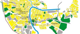
Secrets of the Don: Mysterious Island. Semikarakorsk settlement
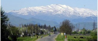
This ancient settlement, which was once a Khazar fortress with a settlement around it, is actually located on an island near the city of Semikarakorsk, one hundred and twenty kilometers upstream from the mouth of the Don.
The island in question is formed by several rivers. The lower reaches of the Don, mainly its left bank, is a labyrinth of such rivers. It’s probably easier to give a picture than to explain which river flows where and whose tributary it is. A river in the traditional sense (that is, there is a source), among them here is a tributary of the Don Sal, while the rest are actually eriks, channels, old channels in the Don floodplain. They are shallow (you can wade), the bottom is muddy, and sometimes there are reed thickets along the banks.
I didn’t call the island mysterious for nothing. If you think about it, much connected with it and with the ancient Khazar settlement located on it is a mystery. The name, the time of existence, the features of the area... This is despite the fact that the settlement has long been known to historians and archaeologists.
Let us recall that Khazaria, the Khazar Kaganate, is a prosperous state for several centuries, formed in the 8th century. It developed in the territories where a stream of immigrants poured from the western coast of the Caspian Sea after the lost war with the Arabs in 721 - 737. The borders of Khazaria extended from the Caucasian foothills, the Lower Volga region to the Middle Dnieper region. Khazaria ended its existence in the second half of the 10th century, when, weakened by waves of Pechenegs coming from the east, it was finished off by the Kyiv prince Svyatoslav in the 960s.
From the point of view of historical geography, there is a fairly clear idea that the settlement is located on one of the former branches of the Great Silk Road (this term, “Great Silk Road” was introduced in 1877 in his work entitled “China” by the famous geographer K. Richthofen for the system of latitudinal routes connecting East and West). The Khazar Kaganate provided its income through transit trade, and the Semikarakor fortress, just like the well-known Sarkel, provided rest and protection for caravans. The caravans moved to the Semikarakorsk fortress along a branch of the Silk Road from the upper reaches of the Manych, and then along the Sal. Then the caravans either crossed the Don, or the goods went by water along the Don to the Sea of Azov. This explains the choice of the location of the fortress - on the left bank of the Don, and not on the higher and more impregnable right. The right one is good for defense (see the Right Bank Tsimlyansk settlement), but protecting trade and performing administrative functions (you have to collect fees from merchants somewhere) are more difficult to implement there.
It is interesting to note, since we are talking about income from transit trade, that the treasures of coins on the territory of the Khazar Kaganate are rare (in contrast to dozens of treasures on the territory of Rus'), and numismatists have practically no information about monetary circulation in the Kaganate (only the most general ones were used by Arab dirhams, made imitations of these dirhams). Either the income and duties were not so large, or the money flowed somewhere immediately, or, on the contrary, it was used very rationally by the Khazar government, without ending up in treasures in the ground - it is not clear.
Now let's look at the local location on the ground. Namely, the fortress itself is placed on the edge of a hill-plateau, above the bank of Salak. I walked through the settlement and the hill with a camera from north to south along Salak. Natural hill. In the vicinity of such hills there are several more; even the outskirts of Semikarakorsk, visible from the Semikarakorsk-Rostov road, are scattered on similar ones. The volume of its soil also speaks in favor of the plateau’s natural origin. And finally, the fact that the dimensions of the fortress itself (its internal dimensions are 210 × 190 m) are significantly smaller than the size of the hill. That is, there is no point in filling it up, so this issue can be considered resolved.
Further-more, and in the literal sense. This hill is surrounded by a water barrier, and the area cut off by water (7-8 square kilometers) is much larger than the size of the hill. Everything seems logical; protective functions must be ensured. Salak, which turned the area into an island, has the correct geometry, with smooth banks, most of the channel is generally straight - undoubted evidence that it was dug on purpose.
But it remains completely unclear - why enclose such a huge territory with a moat? Well, imagine the Moscow Kremlin, from the walls of which moats with water are several kilometers away. What use will such ditches have in defense? The enemy can easily force the crossing or fill up an unprotected barrier (any engineering obstacle must be under the cover of the garrison). It makes more sense to build a moat directly under the walls of the fortress.
I don’t have clear explanations for the discrepancy between the water obstacles and the size of the fortress (it seems that historians and archaeologists don’t either). Perhaps the Salak is the old bed of the Sal, an element of its last loop before flowing into the Don. Probably, the builders of the fortress leveled it and cleaned it - it turned out to be easier than digging around the fortress with a ditch. Even in this case, the scale of the work performed is enormous. Over a vast territory, they could perhaps let horses graze without fear of them running away (the version, of course, is somewhat far-fetched). And even during an enemy attack, the water barrier in any case serves as an obstacle, making it difficult for the attackers to cross.
Let's estimate the volume of excavation work. The dimensions of Salak are 4000 m long, 30 m wide, and 2 meters deep. As a result, we get 240,000 cubic meters of soil.
For comparison, in order to dig around the fortress itself (700 meters of perimeter) with a ditch 10 meters wide and 10 meters deep, which would make it completely impregnable, 70,000 cubic meters are needed.
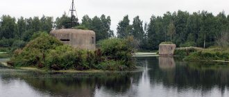
The fortress (and, apparently, the accompanying settlement, the city) are practically not noted in historical sources. Therefore, archeology provides basic information. So, the fortress is quadrangular in plan, dimensions 210 × 190 m, there are no corner towers. The Semikarakorsk fortress is larger in size than the well-known Sarkel (178.6 × 117.8 inside). Inside there is a citadel measuring 70 × 90, it is shifted to the eastern wall. The citadel contained buildings made of baked bricks and had tiled roofs.
In this diagram from the book by M.I. Artamonov “Medieval settlements on the Lower Don” shows a plan of the settlement.
Large mounds adjoin the outer side of the northern wall. There is a reasonable assumption that these are not mounds, but the remains of other structures, ring-shaped in plan, with functions that are still unknown. To the west of the fortress on the hill there are three more mounds, but smaller ones. Another “mound” in appearance is built into the eastern wall, which overlooks the bank of Salak. In fact, these are the ruins of a huge structure, a tower or the so-called donjon. It is assumed that from its height it was possible to view the surrounding area 20 kilometers to the east and 10 kilometers to the west, where the high right bank of the Don rises above the river.
Archaeologists found the remains of an outer wall made of adobe (unfired, sun-dried) brick interspersed with baked bricks - amulets. Perhaps burnt bricks were used for the so-called “shells”, that is, external walls, the space between which was filled with adobe bricks, or for laying out plinths. The wall has no foundation (as in other fortresses of the Khazar Kaganate), the width of the walls is estimated to be from 1.65 to 2.2 meters. The height is estimated at 5-6 meters (with a width-to-height ratio of 1:3). Of course, the top of the fortress wall was a battle platform or a battle passage with battlements, as in other fortresses of the Kaganate. The construction of all defensive structures required more than 2 million bricks. The bricks of the fortress are standardized, 25 × 25 × 4..5 centimeters. Today, due to plowing, the presence of walls on the surface is revealed only by the color of the grass. The construction traditions of the Semikarakor settlement, according to archaeologist S.A. Pletnyova, coincide with the Dagestan ones of that time - the Khazars moved from Dagestan to the Don. There is another opinion. G.E. Afanasyev, also an archaeological scientist, believes that the Semikarakorsk fortress, like other fortresses of Khazaria located on the Don and Seversky Donets, was created by the Khazars centrally, in collaboration with Byzantium, and has features characteristic of late antique and Byzantine fortresses. This is the use of crafted, specially prepared building material such as brick or stone blocks, and proper layout, which goes back to the proper layout of the Roman camp. The fortress walls were capable of performing independent defensive functions, not entirely dependent on the natural topography of the area. Such principles had no continuity with the traditions of the local Slavic, Alan, Turkic or Ugric populations, who, in constructing their more primitive defensive structures, used earth or broken stone and relied on the natural properties of the area. These fortresses marked the western and northwestern borders of the Kaganate.
It is believed that the Semikarakor fortress, an outstanding structure by the standards of the Kaganate, existed at approximately the same time as Sarkel, perhaps a little earlier. However, significantly fewer archaeological finds were made here. But such massive excavations as in Sarkel were not carried out.
Archaeologist and researcher of the Semikarakor fortress V.S. Flerov carefully and with reservations dates the existence of the fortress from no later than the first third of the 9th century until the beginning of the 10th.
The next episode is completely unclear. In 965, the restless Kiev prince Svyatoslav (the same one) fought in Khazaria. Whatever the route reconstructed by scientists, he marched with his army along the Don from its mouth to Sarkel. And Sarkel, as you know, took it. He could not pass by the Semikarakorsk fortress. But this is where historical sources are silent. Why? Did Svyatoslav walk around this city? Got it in between? Did the fortress really no longer exist? Unknown...
Don historian and local historian of the 19th century Evgraf Savelyev describes this place in Essays on the History of Trade on the Don as follows:
Trade route along the river. Salu, as stated above, led caravans to the Ust-Salsky settlement. This settlement is located on a flat hill, on the right side of the Sala River, near the very bank, not far from its confluence with the Don; This area is surrounded from the south and west by the bends of the river. Sala, and from the north - Don. The plan of the settlement represents the figure of a five-sided polygon, with a large rampart; Traces of gates are visible on the northern, southern and western sides. On the rampart in three places the foundations of brick towers are visible, and on the side facing the river, on the rampart itself, there is a very large mound with signs of brick construction. In the middle of the fort there are traces of the foundations of a castle or temple, and not far from it there is a well. Outside the rampart, on the northern side, the remains of a small quadrangular fortification are visible. Opposite the settlement, on both banks of the river, large hewn stones were found in the water, like the remains of a bridge. Around the fort, the earth is mixed with pottery shards, and in some places with ash.
Eastern geographers mention the ancient trading and wealthy city of Ahaz on the river. Tanais, which existed until the 16th century. Karamzin believes that this city stood on the site of the Cossack city of Cherkassk, but this is hardly true. According to ancient legends, Ahaz stood on the Don four days' journey from Azov; If you count 200 stages per day by dry route, i.e. about 30 versts (according to the ancient one), then the city of Ahaz should stand much higher than Cherkassk, 70 versts and nowhere more, as at the mouth of the Sal, since there are signs of other significant settlements up the Don from Azov 120 versts. No. Ahaz was famous for its wealth and abundance, which even became a proverb among the ancients. (Herberstein. Karamzin vol. VII).
Thus, the caravan route along the Sal, having separated from the Alan-Derbent road, passed at the mouth of the Sal to the ancient city, the ruins of which are described above.
Interestingly, the fortified city of Achas, standing opposite the mouth of the Seversky Donets, on the left side of the Don, is depicted in Mercator’s atlas of 1595. This means, in any case, information about the existence of the city of Ahaz was known in Europe in the 16th century. In the same atlas, upstream, where the famous Sarkel was located, the same fortified settlement is indicated with the signature “Weliky prewoz”, the Great Transport. This is how long the memory of these Khazar cities lasted.
Part of the “Tavrica” sheet of the Mercator atlas. Larger
This is what the area looked like in 1880:
It can be seen that the island on which the settlement is located is already (or “still”) a peninsula. Perhaps the area connecting Sal and Don (Old Don River) had dried up by that time. Nowadays it exists again (indicated in red). It appeared as a result of the spring flood of 1917, after which the Sal water went along this short path, and in 1880 it went along Salak (that is, it was a section of Sal). However, it must be assumed that the new channel (in red) was used by the old one, which existed under the Khazars and died out by the 19th century.
The actual name of the fortress is not known for certain (it is possible that this same “Akhaz”). As archaeologist S.A. writes Pletnev, the name of the neighboring village, Semikarakorskaya, is not explained in any way from known sources of the 16th-17th centuries. — the time of the emergence of Cossack villages on the Don. In the word, three Turkic roots are quite distinguishable: semiz - strong, kara - black or sara - yellow, kel - strength. Therefore, Semikarakor means "Strong (strong) black (or yellow) fortress." Archaeologist V.S. Flerov notes that this name is more related to the history of the Don Cossacks. The name of the fortress (and any fortress had to have its own name) in the Khazar Kaganate, the word “Semikarakory” most likely was not. But the Cossacks could name the village after a well-known and nearby object - the ruins of the “black fortress”.
As they say, the mysterious island on which the Khazar fortress stood, a unique monument, continues to keep its secrets...
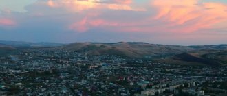
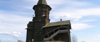
View of the right, high bank of the Don. On the slopes is the village of Razdorskaya.
We climb the hill on which the ancient settlement is located. A look back.
Cliff of the hill towards Salak.
A group of mounds in the northwestern corner of the site
This is what the fort looks like. If you look closely, you can see the remains of a ditch, a rampart (the road crosses them) and mounds.
The “mound” built into the eastern wall is the largest. On the map it is height 17.0
View from the mound to the Semikarakorsk-Rostov road. There was a tower here, and from it you could see much further.
View from the “mound” to the south. A strip of trees shows the bed of Salak. In the right corner, where the wall of trees has a gap - Salak merges with Susat
View from the “mound” to Salak
The road descends from the plateau
A look back at the "mound". The figure of a person shows his scale
From Salak, view of the plateau (southern part). Gives an idea of the height of the plateau.
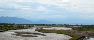
Salak, or Salok, or even Salak
Confluence of Salak and Susat
Susat