Founded: 1726
City Day is celebrated
on December 4
.
Officially, Belovo is a relatively young city
Belovo
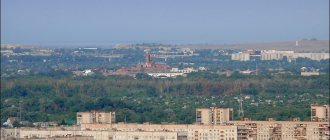
- a city of regional subordination in the Kemerovo region of the Russian Federation, is the administrative center of the district and is part of the Belovsky urban district. It is located in the south of Western Siberia, in the central part of Kuzbass, located approximately midway between Kemerovo and Novokuznetsk (132 and 111 kilometers respectively) and is connected to them by rail and road.
Officially Belovo is a relatively young city - December 4, 1938
By decree of the Presidium of the Supreme Soviet of the RSFSR, the workers' village of Belovo was transformed into a city. This date became City Day, but the history of the emergence of the populated area itself goes back almost three centuries.
According to surviving data, on the site where the city is now located, in 1726
Free settler (or fugitive miner) Fyodor Belov founded the settlement of the same name - Belovo on the banks of the Smorodinovaya River (as the Bachat River was called in the local dialect). And in 1762, this settlement was already mentioned in the registration lists of the Kuznetsk district as the village of Belovo, in which about 300 people lived at that time. Moreover, these were not only Russian settlers, but also representatives of the Teleut tribes, who had lived in these places since ancient times.
Bachatsky coal mine (Photo: belovo42.ru) However, for a long time Belovo remained a small village until coal mining began here.
The fact that there were large deposits of coal in the vicinity of Belovo became known in the mid-19th century; in 1851, the development of coal deposits began - the Bachatskaya mine became the first mine in Kuzbass. And Belovo received even greater development when the Kolchugino-Belovo-Usyaty railway line opened here in 1921, and the village itself became a junction railway station. In 1926 the depot was put into operation. In Soviet times, the development of the coal mining industry proceeded at an active pace, which also led to an increase in cargo transportation. In addition, in 1931 a zinc plant was launched in Belovo (its products were in great demand in the USSR), and two years later the Pionerka mine was put into operation. These industrial enterprises determined the basis of Belovo’s industrial potential for many years. And on December 4, 1938, the working village of Belovo received city status.
During the Great Patriotic War, several evacuated enterprises were located in the city, hospitals were located in schools, and the city population helped the wounded soldiers in any way they could. In the post-war years, the development of coal enterprises continued; in 1947, the first coal mine, Krasnobrodsky, was opened; in 1949, another mine, Bachatsky, produced the first coal. The city itself was actively being built, its population was growing. In September 1955, the construction of the Belovskaya State District Power Plant began, in which volunteers from all over the country took part.
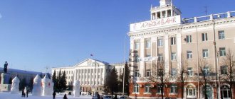
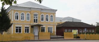
Central Palace of Culture (Photo: belovo42.ru)
After the collapse of the USSR and with the beginning of the restructuring of the coal industry and the redistribution of property, many industrial giants of the city closed, but today Belovo continues to be a major industrial center of Kuzbass, occupying leading positions in many positions in the region.
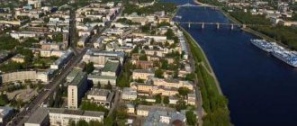
The city's economy is based on enterprises of the fuel and energy complex and transport. Priority activities are electricity and mining, and primarily the coal industry. The city is located in the geological and economic zone of two main coal deposits: Belovsky and Bachatsky. The current coal industry consists of mines, open-pit mines, and processing plants. About 12% of Kuzbass crushed stone and gravel is produced here. Belovo is also a large railway and important transport hub of Kuzbass.
The city is also unique in its administrative “structure” - it practically consists of several small “towns” scattered over an area of about 219 square meters. kilometers. This is the central part of the city and remote areas, usually called workers' villages. The main water artery of Belov is the Bachat River and its tributaries.
The population of Belovo is about 70 thousand people (2021). Representatives of more than 22 nationalities live here: Russians, Tatars, Ukrainians, Chuvashs, Germans, Mordovians, Teleuts, Shors and others.
Day of the city
Residents of Belovo are celebrated annually on December 4, in honor of the date it was awarded the status of a city.
About the city in general
Our city is located in the Kemerovo region.
Small, boring, freezing temperatures, people... Eh... Compared to other cities in the Kemerovo region, our city is in 13th place out of 20. The city itself was founded in 1939. There once were 100 thousand people in the city... It was once better in it... But I have nothing more to add about the city as a whole, because it is not so big and interesting. I will write about something else in the following headings. By the way, our city is quiet, nothing happens (except that one of several schools was renovated, but even that was only a joy for the locals). The media did not write about this. And it's not worth it.
Coat of arms
The coat of arms of Belovo is a heraldic shield, in the azure field of which, under a silver concave birch-leaf head, a miner's lamp of the same metal with a scarlet flame and a black safety grille, placed on two gold crossed picks, is depicted. The shield is crowned with a golden three-tower crown. As follows from the description of the symbolism of the coat of arms: “The silver chapter is a vowel emblem for the name of the city. Birch leaves indicate the emergence of a settlement in a place rich in birch forests and the initial occupation of its inhabitants - producing charcoal. In addition, birch, as a tree of birth and beginning, indicates primacy in the discovery and development of coal deposits. The lamp and pickaxes represent the coal mining mentioned above. The combination of silver and azure is intended to show the peaceful nature of the territory, its inhabitants and their work, as well as the dignity found in work. The image of pickaxes in gold is a symbol of labor glory.”
Population
Our population for 2022 (there is no figure for 2022 yet) is only 70,611 thousand. And, no, this is not population growth, this is population decline. In 2022 there were 71 thousand-something. I repeat: at one time the population was 118 thousand. Because the city is absolutely unpromising. And people have already become acquainted with each other. Before I had time to meet my friend, and it seemed like there were no mutual acquaintances, I was already exhaling with joy, when suddenly it turned out that we had a mutual friend, a hairdresser, who cuts our hair. And then it turned out that there was another friend. Hmmm.
There is also nothing for the population to do here, except walk aimlessly. And then, preferably with the presence of an acquaintance, otherwise they will look askance at you as if you were an alien. These are the people, this is the population. The only people left here are those who don’t care where they live and whose motto is “where you were born, you will come in handy.” Or people who want peace. Others are leaving.
What can we say, the population is declining throughout the Kemerovo region. Even Kemerovo itself, where many were drawn before, no longer shines with prospects, and people are trying to leave there. Those who don’t want to go far or who still like such cities go to Kemerovo. Personally, as far as I know, only two of my friends are going to Kemerovo. Another has already left for Tyumen, the third is going to St. Petersburg. The fourth may go to Novosibirsk. The fifth is going to Altai or, like the third, to St. Petersburg. Or, having believed in himself, he will leave to conquer Moscow. The neighbors are young too - one went to Novosibirsk, the other to Tula. Another acquaintance in Anapa.
The history of the city of Belovo
The city of Belovo, according to historical scale, arose quite recently and can safely be called young. All settlements that appeared along the banks of the Ini River were nomadic in nature for a long time. And only in 1726 the land plot of the fugitive peasant Fyodor Belov appeared here, attached to the Kolyvano-Voskremensky mines. Only 20 years later, a small village appeared on the map, named after the surname of that very first settler. So, the city gradually grew. And its close proximity to coal deposits closely connected the local population with the mining industry.
City infrastructure
There is nothing special to describe, but I will try to squeeze out all the juices.
There is a central park. The only park with attractions, of which there are few and not so interesting. Previously there were more of them, but after the renovation, out of 12 there were only 6 left + one playground. And the park area has also shrunk, although it has been improved.
That year in the summer I decided to go to the old territory of the park with a friend, but we were almost forcibly pushed out of there by some unbalanced lady who decided to turn it into an enclosure for her dog. Although this is not written or said anywhere. Just the usual insolence and appropriation of territory for oneself, you see, there is nowhere in the city to walk a dog.
We also have a Youth Park, where there is absolutely nothing to do except walk and sit on benches. Only in summer there is a fountain, there are all sorts of shops with food and water, trampolines, cars for children and water balloons.
There is also Victory Park, which more or less began to resemble a park, because statues of the Katyusha combat vehicle and a tank were added there. There is also almost no vegetation, a children's playground (yeah, where would we be without it) is present, a trampoline appears in the summer, and an ice skating rink in the winter.
The city has a small-sized entertainment center, which is mostly based on bowling.
Nothing else. Perhaps in the private sector they can offer two large playgrounds, and even then only in one part.
There are only 6 schools in the whole city. One gymnasium. And then, everything is overcrowded. I don’t know about kindergartens, but there are clearly more than schools.
Districts
Yes, oddly enough, we do have districts in the city. And even several. But maps often count villages that are nearby. I’ll probably write about this in conclusion. And now about the regions.
District Private sector
It consists of private houses, there is a “cut off” part of the area, which is located near high-rise buildings. The area is quite large, located on one part of the city (except for the “cut off” part). Prices are reasonable. That is, it won’t work out like in the southern regions - a small piece of land in some village for 3,000,000. We are fine with this.
There is one school, number 11, for this entire area. And it’s terribly overcrowded, so if you buy a house here, then in addition the child will have to walk far to school and see a cemetery nearby. Not promising for families with children. Your child will simply not be accepted into school due to the lack of places. In another part there is school 28, I don’t know how things are there. Homes in this area are sometimes updated with newer ones. But it is not being built up.
District Center
The largest district in the city. And the main one. Competes with another area that will be described later. The center is not a prestigious area, the houses are average, the prices are also reasonable. If you want to buy an apartment, the area is suitable, of course, everything is nearby, except for schools... The schools are also not crowded. There are two schools in this entire area, 8 and 10. And a gymnasium. There are no places again. But there are many shops nearby. Everything you need is right here. But there is a central park and Molodezhny park. The area is not being developed.
4th microdistrict
Only cottages. Only for rich people. Royal mansions. Two-story houses, rich people - everything is there. There is nothing to say about it, there is nothing there except houses. Even shops. Everything is purchased in the nearest areas. I don’t know about the development of the area.
Third microdistrict
The same microdistrict that is the second largest in the city. It is he who is “at war” with the Center. There are new houses here, recently built. The area has recently grown by + 1 house. It will no longer be built up, but it is the youngest. There are two sub-parks there. You can buy almost everything there too.
School 14 and 32 available. It is impossible to enroll in school 14 - there are no places, first-graders study in the annex. At 32 there was renovation - interactive whiteboards (which hurt your eyes), a schedule on the TV screen, things with chargers for phones, and chairs... The chairs on the second floor are blue, on the third green (not in all classes) and on the first floor - yellow- lemon color. Every speck of dust is visible on the chairs. By the way, the school is not full, there is a chance of getting there. Prices depend on the apartment and its location.
Pine Quarter
Neighborhood under construction. Adjacent across the road to the 3rd microdistrict. So far there are only high-rise buildings there, and a kindergarten and school are being built. I don’t know what to do next. But due to the construction of this quarter, the forest consisting of pine trees is being cut down. It's a pity. I don’t know the housing prices there.
There is nothing more to write about him.
6th microdistrict
A microdistrict consisting of just one house and a center with entertainment for children, a Krasnoe&Beloe store and an Ozon distribution point. And a gas station. People from the 6th microdistrict get all the delights of life in the 3rd microdistrict, which is next door. By the way, next to the 3rd microdistrict borders that very “cut off” area of the private sector.
District Zinc Plant
From the plant itself there are only abandoned workshops, the area is unpopular, there are no schools. There is also a semi-operating Kuzbassradio plant. There is a mixture of private houses and high-rise buildings. It is located on the border with the Center and is farthest at the exit/entry from/to the city(s). There is nothing to talk about him either. Prices are most likely acceptable for living space, since the area is at the end of the city and is not developing in any way. There are also a lot of abandoned buildings there, the former Polyana supermarket, and the Sibirsky Gorodok supermarket, which is already renting out, with everything you need (except food).
5th microdistrict
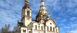
There is no building. Only the church. Located next to the 6th microdistrict, bordering on the private sector. Almost no one even considers it a district, since there is only a church there.
Microdistrict Sovkhozny
An area that I had never been to and only recently discovered. Remote. On the edge of the city, it consists of private houses, there is nothing. Even a store. By location, apparently when the city was smaller it was a real state farm. House prices there are probably the lowest in the city.
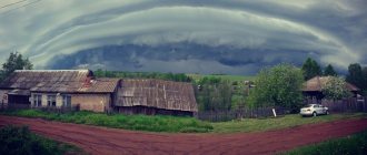
Photo by Anton Konobeitsev
Map
| Belovo: maps |
Belovo: photo from space (Google Maps) Belovo: photo from space (Microsoft Virtual Earth)
| Belovo. Nearest cities. Distances in km. on the map (in brackets along roads) + direction. Using the hyperlink in the distance , you can get the route (information courtesy of the AutoTransInfo website) | |||
| 1 | Inskaya | 8 (15) | IN |
| 2 | New Town | 12 () | YU |
| 3 | Gramoteino | 13 (24) | WITH |
| 4 | Bachatsky | 19 () | SW |
| 5 | Polysayevo | 20 (31) | WITH |
| 6 | Leninsk-Kuznetsky | 27 (41) | WITH |
| 7 | Guryevsk | 28 (28) | SW |
| 8 | Krasnobrodsky | 30 (90) | YU |
| 9 | Salair | 38 (47) | SW |
| 10 | Kiselevsk | 50 (65) | SE |
| 11 | Prokopyevsk | 65 (82) | SE |
| 12 | Industrial | 70 (155) | NW |
| 13 | Plotnikovo | 71 (114) | WITH |
| 14 | Krapivinsky | 72 (107) | NE |
| 15 | Novokuznetsk | 91 (122) | SE |
| 16 | Metal site | 100 () | WITH |
| 17 | Kemerovo | 105 (115) | WITH |
| 18 | Fireboxes | 105 (147) | NW |
| 19 | Togul (Altai region) | 108 (219) | YU |
| 20 | Taizhina | 109 (158) | SE |
| 21 | Osinniki | 111 (145) | SE |
| 22 | Zalesovo (Altai region) | 112 (152) | SW |
| 23 | Kaltan | 118 (157) | SE |
| 24 | Zarinsk | 120 (126) | SW |
a brief description of
The city is located in the Kuznetsk basin on the river. Bachat, 170 km south of Kemerovo. Railway station.
Territory (sq. km): 219
Information about the city of Belovo on the Russian Wikipedia site
Historical sketch
Known since 1726 as the village of Belovo. Named after the fugitive peasant Fyodor Belov, who founded a zaimka (a special type of settlement) on the banks of the river. Bachat. In 1855 (1851?) the development of coal deposits began.
Workers' village of Belovo since March 20, 1931. City since 1938.
Municipal indicators
| Index | 1999 | 2001 | 2003 | 2005 |
| Demography | ||||
| Number of births, per 1000 population | 8.1 | 9.9 | 11.3 | 11.7 |
| Number of deaths, per 1000 population | 16.2 | 17.3 | 18.4 | 19.5 |
| Natural increase (decrease), per 1000 population | -8.1 | -7.4 | -7.1 | -7.8 |
| Standard of living of the population and social sphere | ||||
| Average monthly nominal accrued wages, rub. | 1933 | 3786 | 5890 | 9252 |
| Average housing area per inhabitant (at the end of the year), sq.m. | 18.6 | 19.4 | 20.2 | 21 |
| Number of preschool institutions, pcs. | 47 | 46 | 46 | 46 |
| Number of children in preschool institutions, thousand people | 4.5 | 4.7 | 4.8 | 5.2 |
| Enrollment of children in preschool educational institutions (at the end of the year), as a percentage of the number of children of the corresponding age, % | 57.4 | 59.6 | ||
| Number of daytime educational institutions (at the beginning of the school year), pcs. | 42 | 41 | 40 | 41 |
| Number of students in daytime educational institutions, thousand people | 25.2 | 23.4 | 20.3 | 18 |
| Number of doctors, people. | 595 | 551 | 542 | 534 |
| Number of nursing staff, people. | 2003 | 1765 | 1771 | 1722 |
| Number of hospital institutions, pcs. | 11 | 12 | 12 | 12 |
| Number of hospital beds, thousand units | 1.4 | 1.4 | 1.3 | 1.3 |
| Number of medical outpatient clinics, pcs. | 20 | 31 | 29 | 36 |
| Capacity of medical outpatient clinics, visits per shift, thousand units. | 3.1 | 3.1 | 3.4 | 3.4 |
| Number of registered crimes, pcs. | 2922 | 3126 | 2840 | 3210 |
| Persons who committed crimes were identified, persons. | 1907 | 2084 | 1965 | 1563 |
| Economy, industry | ||||
| Number of enterprises and organizations (at the end of the year), pcs. | 1608 | 1883 | 1988 | 2141 |
| Number of operating enterprises by type of activity: mining (at the end of the year), pcs. | 24 | |||
| Number of operating enterprises by type of activity: manufacturing (at the end of the year), pcs. | 91 | |||
| Number of operating enterprises by type of activity production and distribution of electricity, gas and water (at the end of the year), pcs. | 80 | |||
| Volume of shipped goods of own production by type of mining (in actual prices), million rubles. | 12055 | |||
| Volume of shipped goods of own production by type of manufacturing (in actual prices), million rubles. | 1020.7 | |||
| Volume of shipped goods of own production by type of production and distribution of electricity, gas and water (in actual current prices), million rubles. | 5264 | |||
| Construction | ||||
| Volume of work performed by type of activity “Construction” (until 2004 - volume of work performed under construction contracts), million rubles. | 201.3 | 381.6 | 518.4 | 1233.5 |
| Commissioning of residential buildings, thousand sq.m. of total area | 32.3 | 24.2 | 35.2 | 41.5 |
| Commissioning of residential buildings, apartments | 378 | 344 | 437 | 424 |
| Commissioning of preschool institutions, places | 0 | 0 | 0 | 0 |
| Commissioning of educational institutions, places | 0 | 0 | 1075 | 0 |
| Commissioning of hospital facilities, beds | 0 | 47 | 0 | 0 |
| Commissioning of outpatient clinics, visits per shift | 0 | 0 | 200 | 0 |
| Transport | ||||
| Number of bus routes (in intracity traffic), pcs. | 5 | 6 | 6 | 7 |
| Number of tram routes, pcs. | 0 | |||
| Number of trolleybus routes, pcs. | 0 | 0 | ||
| Number of passengers transported by buses per year (in intracity traffic), million people. | 18.1 | 19 | 10.1 | 8.5 |
| Number of passengers transported by trams per year, million people. | 0 | |||
| Number of passengers transported by trolleybuses per year, million people. | 0 | |||
| Connection | ||||
| Number of residential telephone sets of the city public telephone network, thousand units. | 13.1 | 14.5 | 16.1 | 21.4 |
| Number of payphones of the city telephone network (including universal ones), pcs. | 52 | 52 | ||
| Trade and services to the population | ||||
| Retail trade turnover (in actual prices), million rubles. | 1279 | 2474 | 3400 | 5252 |
| Retail trade turnover (in actual prices), per capita, rub. | 7679 | 15177 | 21493 | 33906 |
| Index of physical volume of retail trade turnover, % compared to the previous year | 105.1 | 115 | ||
| Public catering turnover (in actual prices), million rubles. | 45.8 | 91.7 | 117.7 | 227.8 |
| Index of physical volume of public catering turnover, % compared to the previous year | 101.3 | 127.2 | ||
| Number of stores, pavilions (at the end of the year), pcs. | 61 | 102 | ||
| Sales area of shops, pavilions (at the end of the year), sq.m. | 3771 | 5078 | ||
| Volume of paid services to the population (in actual prices), million rubles. | 314.2 | 529.9 | 852.8 | 1291.1 |
| Volume of paid services to the population (in actual prices), per capita, rub. | 1886 | 3251 | 5391 | 8335.1 |
| Volume of household services to the population (in actual prices), million rubles. | 56.3 | 98.8 | 137 | 192.5 |
| Volume of household services to the population (in actual prices), per capita, rub. | 338 | 605.9 | 866.2 | 1243 |
| Investments | ||||
| Investments in fixed assets (in actual prices), million rubles. | 752 | 1107 | 1322 | 3587.9 |
| Share of investments in fixed assets financed from budgetary funds in the total volume of investments, % | 6.3 | 9.4 | 7.5 | 4.2 |
Data sources:
- Regions of Russia. Main characteristics of the constituent entities of the Russian Federation: statistical collection. Goskomstat of Russia. - M:, 2003.
- Regions of Russia. Volume 1. Statistical collection. Goskomstat of Russia. - M:, 2001. p. 517
- Regions of Russia. Basic socio-economic indicators of cities. Statistical collection. Rosstat. - M:, 2005. p. 323
- Regions of Russia. Basic socio-economic indicators of cities. 2006. Statistical collection. Rosstat. - M:, 2006. p. 319
Universities of the city
Siberian State Transport University (Belovsky branch)
652612, Kemerovo region, Belovo, st. Lenina, 67-a
Museums, galleries, exhibition halls
Bekovsky District Historical and Ethnographic Museum 652652, Kemerovo region, Belovsky district, village.
Bekovo Phone(s): (8252) 4-3325 Exhibition hall, Vernissage gallery 652600, Kemerovo region, Belovo, st. Yubileinaya, 18 Phone(s): (38452) 2-37-45
Museum of History and Local Lore 652600, Kemerovo region, Belovo, st. Yubileinaya, 12 Phone(s): (38452) 21-605
| Population by year (thousands of inhabitants) | |||||||
| 1931 | 11.9 | 1982 | 114 | 2006 | 77.9 | 2016 | 73.4 |
| 1939 | 43.3 | 1986 | 117 | 2007 | 76.7 | 2017 | 72.8 |
| 1959 | 106.9 | 1989 | 93.1 | 2008 | 75.8 | 2018 | 72.5 |
| 1962 | 118 | 1992 | 92.3 | 2010 | 74.0 | 2019 | 71.8 |
| 1967 | 116 | 1998 | 83.7 | 2011 | 76.8 | 2020 | 71.2 |
| 1970 | 108.2 | 2000 | 80.2 | 2012 | 75.5 | 2021 | 70.6 |
| 1973 | 109 | 2001 | 78.3 | 2013 | 75.0 | ||
| 1976 | 110 | 2003 | 82.4 | 2014 | 74.3 | ||
| 1979 | 111.8 | 2005 | 79.3 | 2015 | 74.0 | ||