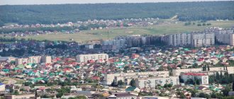
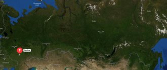
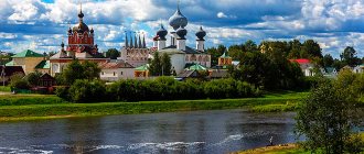
Vyshny Volochyok
(Tver region)
OKATO code:
28414
Founded:
1471
City since:
1770 City of regional subordination
Center:
Vyshnevolotsky district
Urban-type settlements, population as of 01/1/2021
| Krasnomaysky | 4.4 |
| Telephone code (reference phone) | |
| 48233***** | 12-3-98 |
Deviation from Moscow time, hours:
0
Geographic latitude:
57°35′
Geographic longitude:
34°34′
Altitude above sea level, meters:
160 Sunrise and sunset times of the Sun and Moon in the city of Vyshny Volochyok
Routes on the map of Vyshny Volochok. Transport infrastructure
Two major highways M10 Moscow - St. Petersburg and the regional highway 28K-0034 Vyshny Volochyok - Sonkovo pass through the city.
The railway and the station building (Vyshny Volochyok, Zheleznodorozhnaya St.) appeared in Vyshny Volochyok from the middle of the 19th century. From the station depart:
- high-speed express trains "Sapsan"; the distance from Moscow to Vyshny Volochok (290 km) by express train takes 2 hours, to St. Petersburg (distance 365 km) it takes 2.5 hours;
- electric trains to Tver (distance 120 km): they run 3-4 times a day, travel time is 2 hours.
- commuter trains from Tver to Bologoye – daily, every 3-4 hours.
M10 federal highway passes through Vyshny Volochyok . Intense traffic (32 thousand cars per day) creates traffic jams in the city center and worsens its ecology. The M11 bypass highway, opened in 2014, has diverted the flow of passenger traffic, while trucks continue to move through the center. The state of the roads is shown by a satellite map of Vyshny Volochyok (“Traffic Traffic” option).
Intercity flights:
- From Tver through Vyshny Volochek there are buses to Udomlya and Firovo.
- The morning express Vyshny Volochyok - Tver can deliver to Torzhok, where there are no direct train services and commercial minibuses do not call.
- Once a day there is a flight in the northern direction: Vyshny Volochyok - Veliky Novgorod.
City buses connect the center with the outskirts of the city and suburban villages.
Map
| Vyshny Volochyok: maps |
Vyshny Volochyok: photo from space (Google Maps) Vyshny Volochyok: photo from space (Microsoft Virtual Earth)
| Vyshny Volochyok. Nearest cities. Distances in km. on the map (in brackets along roads) + direction. Using the hyperlink in the distance , you can get the route (information courtesy of the AutoTransInfo website) | |||
| 1 | Spirovo | 31 (48) | SE |
| 2 | Udomlya | 42 (51) | NE |
| 3 | Bologoe | 45 (54) | NW |
| 4 | Firovo | 52 () | Z |
| 5 | Ozerny | 60 () | NW |
| 6 | Kuvshinovo | 65 (124) | YU |
| 7 | Torzhok | 65 (74) | YU |
| 8 | Likhoslavl | 74 (109) | SE |
| 9 | Maksatikha | 81 (92) | IN |
| 10 | Valdai | 88 (90) | NW |
| 11 | Frames | 92 (152) | IN |
| 12 | Lesnoye | 96 (172) | NE |
| 13 | Borovichi | 98 (139) | NW |
| 14 | Ostashkov | 100 (200) | SW |
| 15 | Moshenskoye (Novgorod region) | 102 (192) | WITH |
| 16 | Selizharovo | 105 (247) | SW |
| 17 | Tver | 113 (132) | SE |
| 18 | Okulovka | 115 (176) | NW |
| 19 | oxbow | 120 (136) | YU |
a brief description of
Located on the northeastern edge of the Valdai Upland, on the river. Tsna, 119 km northwest of Tver.
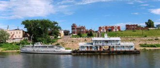
Pier on the Vyshnevolotsk reservoir. Railway station.
Territory (sq. km): 54
Information about the city of Vyshny Volochyok on the Russian Wikipedia site
Historical sketch
It arose as a settlement on the trade route from Novgorod to Moscow - a portage between the rivers Msta (the basin of Lake Ilmen) and Tvertsa (the left tributary of the Volga), known since 1471. Portage (diminished volochok) - a land section of the waterway on which ships using simple devices (skating rinks, gates) or simply by muscular force were transported across the watershed from one river to another. The definition “vyshny” (i.e. “upper”) contrasted it with the Lower Volochok, located downstream of the river. Msta (they walked along the Msta rapids).
Goods lifted on small ships to the Nikolo-Stolbenskaya pier were unloaded and transported by tug to the river. Tsna, where Vyshny Volochyok was located.
In the 16th century a large craft village was called Nikolsky Pogost or Pogost on Vyshny Volochok.
In 1703-1722. By order of Peter I, under the leadership of Dutch craftsmen, a canal was built near Vyshny Volochok - the first artificial waterway connecting the river basin. Volga with St. Petersburg. The route through Msta and Tvertsa to the Volga was one of the important routes of communication between Western countries and the countries of Southeast Asia.
From the 18th century sawmills, mills, and forges began to appear in Vyshny Volochyok and its environs, and shipbuilding developed. But the main occupation of the city’s population was servicing ships passing through the Vyshnevolotsk water system.
Since 1770, Vyshny Volochyok has been a city in the Novgorod province. Since 1775, the district city of the Tver governorship (since 1796 - Tver province).
In the second half of the 19th century. Vyshny Volochyok is a major center of the textile industry. It was one of the most comfortable cities in the Tver province. It was decorated with canals and locks, surrounded by gardens and boulevards.
With the reduction of traffic along the Vyshnevolotsk water system and the formation of new shopping centers near the railway (Bologoye, Spirovo), the economic importance of the city fell sharply.
In 1856, in the district town of Vyshny Volochyok, Tver province, there were 5 churches, 1671 houses, 226 shops.
Until 1917, Vyshny Volochyok was a place of political exile. Here she was served by V.G. Korolenko, V.P. Obnorsky.
Municipal indicators
| Index | 2001 |
| Demography | |
| Number of births, per 1000 population | 7.9 |
| Number of deaths, per 1000 population | 25.2 |
| Natural increase (decrease), per 1000 population | -17.3 |
| Standard of living of the population and social sphere | |
| Average monthly nominal accrued wages, rub. | 2185 |
| Average housing area per inhabitant (at the end of the year), sq.m. | 23 |
| Number of preschool institutions, pcs. | 19 |
| Number of children in preschool institutions, thousand people | 1.5 |
| Number of daytime educational institutions (at the beginning of the school year), pcs. | 17 |
| Number of students in daytime educational institutions, thousand people | 7.2 |
| Number of doctors, people. | 276 |
| Number of nursing staff, people. | 931 |
| Number of hospital institutions, pcs. | 4 |
| Number of hospital beds, thousand units | 0.9 |
| Number of medical outpatient clinics, pcs. | 6 |
| Capacity of medical outpatient clinics, visits per shift, thousand units. | 0.8 |
| Number of registered crimes, pcs. | 1950 |
| Persons who committed crimes were identified, persons. | 1213 |
| Economy, industry | |
| Number of enterprises and organizations (at the end of the year), pcs. | 1166 |
| Construction | |
| Volume of work performed by type of activity “Construction” (until 2004 - volume of work performed under construction contracts), million rubles. | 77.3 |
| Commissioning of residential buildings, thousand sq.m. of total area | 3.1 |
| Commissioning of residential buildings, apartments | 26 |
| Commissioning of preschool institutions, places | 0 |
| Commissioning of educational institutions, places | 0 |
| Commissioning of hospital facilities, beds | 0 |
| Commissioning of outpatient clinics, visits per shift | 0 |
| Transport | |
| Number of bus routes (in intracity traffic), pcs. | 9 |
| Number of passengers transported by buses per year (in intracity traffic), million people. | 21.3 |
| Connection | |
| Number of residential telephone sets of the city public telephone network, thousand units. | 7.1 |
| Trade and services to the population | |
| Retail trade turnover (in actual prices), million rubles. | 900.9 |
| Retail trade turnover (in actual prices), per capita, rub. | 10032 |
| Public catering turnover (in actual prices), million rubles. | 12.1 |
| Volume of paid services to the population (in actual prices), million rubles. | 186.4 |
| Volume of paid services to the population (in actual prices), per capita, rub. | 2076 |
| Volume of household services to the population (in actual prices), million rubles. | 18.3 |
| Volume of household services to the population (in actual prices), per capita, rub. | 204 |
| Investments | |
| Investments in fixed assets (in actual prices), million rubles. | 74.5 |
| Share of investments in fixed assets financed from budgetary funds in the total volume of investments, % | 7.3 |
Data sources:
- Regions of Russia. Main characteristics of the constituent entities of the Russian Federation: statistical collection. Goskomstat of Russia. - M:, 2003.
Economy
Cotton and paper mill. Spinning, weaving, knitting factories. Experimental glass and woodworking factories.
Factory "Piano" (production of pianos, guitars), mirror-baguette, etc. Food industry enterprises.
In the Vyshnevolotsky district, in the village of Krasnoarmeysky, there is a glass factory; in the village of Zelenogorsky there is a plant for enzyme preparations.
Main enterprises
WOOD PROCESSING INDUSTRY
OJSC "Vyshnevolotsky Furniture DOK"
171110, Tver region, Vyshny Volochyok, st.
Lesozavodskaya, 3 Offers:
chipboard, furniture, wood resin, texture paper
GLASS INDUSTRY
JSC StekloBolshevichka
171110, Tver region, Vyshny Volochyok, Bread Factory yard
Offers:
cotton fabrics, gray fabrics, gauze
Culture, science, education
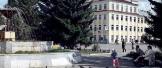
Drama Theater.
Museum of Local Lore.
Universities of the city
Tver State Technical University (Vyshnevolotsk branch)
171158, Tver region, Vyshny Volochyok, st. Demyan Bednogo, 72/64
Museums, galleries, exhibition halls
Vyshnevolotsk Museum of Local Lore 171110, Tver Region, Vyshny Volochyok, Kazansky Ave., 63-65 Phone(s): (48233) 613-23 Website: https://tvermuzeum.ru/
City Interschool Museum of Sailors- veterans of Vyshny Volochyok 171110, Tver region, Vyshny Volochyok, st. Volodarskogo, 75 boarding school N2 Phone(s): (233) 218-05
Architecture, sights
The appearance of the city is mainly determined by the industrial and residential buildings of the 19th and 20th centuries. In the center, shopping arcades (1837, 1852), the Transfiguration Church (1783), the canal embankment (18th century), and the Kazan Convent complex (1880s) have been preserved.
On the right bank of the river. Tsna, at the granite gateway, is a two-story stone house (1703-19), where Peter I stayed.
| Population by year (thousands of inhabitants) | |||||||
| 1856 | 8.3 | 1973 | 76 | 2001 | 58.7 | 2014 | 49.4 |
| 1897 | 16.6 | 1976 | 73 | 2003 | 56.4 | 2015 | 48.8 |
| 1913 | 19.2 | 1979 | 71.7 | 2005 | 54.6 | 2016 | 48.2 |
| 1926 | 31.3 | 1982 | 71 | 2006 | 53.8 | 2017 | 47.7 |
| 1931 | 37.6 | 1986 | 71 | 2007 | 53.0 | 2018 | 46.9 |
| 1939 | 63.6 | 1989 | 64.8 | 2008 | 52.3 | 2019 | 46.2 |
| 1959 | 66.4 | 1992 | 64.3 | 2010 | 51.4 | 2020 | 45.5 |
| 1962 | 71 | 1996 | 62.7 | 2011 | 52.4 | 2021 | 44.7 |
| 1967 | 73 | 1998 | 61.3 | 2012 | 51.3 | ||
| 1970 | 73.7 | 2000 | 59.7 | 2013 | 50.3 | ||
Vyshny Volochyok on the map of Russia: geography, nature and climate
The city is located in the northeast of the Valdai Upland , the area is famous for its abundance of reservoirs and is called Tverskoye Poozerye . In the north and west there are two large reservoirs: Mstinskoye and Vyshnevolotskoye the Tvertsa River flows , and to the east there is a network of lakes and small rivers. The total water surface area of the urban area is 200 km2, and the land area is 54 km.
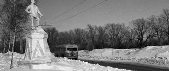
The city is riddled with canals and river channels, has 30 bridges, and 32 km long embankments - a real Russian Venice.
The nature of Vyshny Volochok is captured in the canvases of Venetsianov, Nesterov, Levitan, Kuindzhi, Repin, who worked in its vicinity.
Natural attractions
The banks of the Tsna River, on which the city stands, are famous for their beautiful views and untouched wildlife. Walking through green parks and forests is a pleasure.
Tsna River
- Coordinates: 57.577457, 34.555277.
The embankments of Tsna are not equipped for tourists. There are no changing cabins, sun loungers, souvenir shops or railings for entering the water. But the lack of amenities doesn't dampen weekends by the river. Walking through the forests, swimming in specially designated areas and areas for lighting fires - this is more than enough for outdoor recreation. Thanks to the long coastline, it is never crowded due to the crowd of tourists and you can always find a quiet, secluded corner.
Tekstilshchikov Park
- Coordinates: 57.580499, 34.552627.
A wonderful natural place in the city center, which, however, is not at all well-kept. The park is located on two islands surrounded by canals and a river. There are several bridges leading here where you can take good photos. The place is very well located, but for some reason no one wants to improve it.
Beishlot
- Coordinates: 57.581030, 34.546900.
Also known as the Verkhne-Tsninskaya dam. Beishlot was designed by Mikhail Serdyukov and installed in 1720. Thanks to the dam, many reservoirs and artificial lakes were formed, which later supported navigation along the Tsna canals.
In 1786, Beishlot was improved: its structure was strengthened, and the wooden foundations were replaced with granite ones. Created in the 18th century, the dam is still in operation today. There is a log bridge across it, and on the banks there are gazebos and recreation areas.
Tsninsky Canal
- Coordinates: 57.587895, 34.546825.
The Tsna Canal was dug in 1722. Its main purpose was to straighten the Tsna channel. The length of the canal reaches 1 km, and the depth is 300 m. Park areas with walking paths, comfortable benches and bridges across the canal stretch along the reservoir. The parks are kept clean; pollution of forests and water is punishable by a fine.
Lake Mstino
- Coordinates: 57.670493, 34.504074.
One of the largest natural lakes in the Tver region. Several rivers flow into it - Tsna, Msta, Rudinka and Rundyovka. The coastal landscape is varied, with forests, swamps, hills and plains.
Mstino is the most important recreational center of Vyshny Volochok. On its territory there are sanatoriums and recreation centers; the most prestigious are Serebryaniki, Valentinovka and Academic Dacha, operating since 1884.
Vyshnevolotskoye Reservoir
- Coordinates: 57.563677, 34.446160.
The waters of the reservoir fill the valleys of the Tsna and Shlina rivers. The creeks are unsuitable for swimming due to large accumulations of algae. But fishing is very popular here. Fishing on the reservoir brings good catches of perch, bream and crucian carp, and occasionally pike are caught.